Home
Images
Vectors
Videos
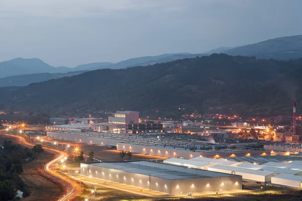
Stock image aerial top view photo of modern industrial zone settled by the highway
Published:
Oct.02, 2020 07:44:35
Author:
yalcinsonat1
Views:
3
Downloads:
0
File type:
image
/
jpg
File size:
13.78 MB
Orginal size:
5464
x
3640
px
Available sizes:
S
(500 x 333)
M
(1000 x 666)
L
(2000 x 1332)
XL
(5464 x 3640)
EL0
(5464 x 3640)
Level:
bronze
Download Image
Image topics:
View
Design
Business
Commercial
Metal
Sunlight
Outdoors
Outdoor
Transport
Transportation
Industrial
Speed
Road
Traffic
Machine
Modern
Architecture
Building
City
Construction
Industry
Structure
Urban
Work
Highway
Site
Residential
Buildings
Engineer
Texas
Above
Structures
Elevated
Aerial
Expressway
Overpass
Houston
Drone
Interchange
Aerial View
Under Construction
New Construction
Industrial Background
Construction Area
Aerial City
Drone Landscape
Similar stock images
Podgorica Airport Aerial
3000 × 2000
Aerial Panoramic View Goods Warehouse Logistics Center Industrial City Zone Near Neighbourhood Suburban Homes In Avondale Residential Area Landscape With Among Desert The Arizona USA.
4789 × 3192
Drone Aerial Photography Of The Platforms Solar De Almera Center For Research Into Solar Energy Use
5464 × 3640
A Momcilov Grad Fortress Pirot Serbia
5602 × 3735
Aerial Views Of Rows Of Greenhouses Taken By Drone. Greenhouse Roofs Background Texture.
8064 × 6048
SAN FRANCISCO - May 31,USA: View Of Tesla Motors Factory Situated In Silicon Valley, East San Francisco Bay Area, California
7360 × 4912
View Of The City Of The Capital Of Israel
5464 × 3640
View On The Road Station In The City
7360 × 4912