Home
Images
Vectors
Videos
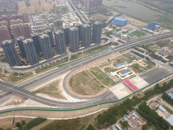
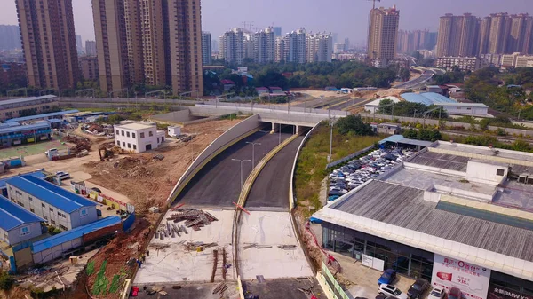
Stock image Aerial view of Guangxi's longest elevated road to open to traffic in Nanning city, south China's Guangxi Zhuang Autonomous Region, 4 November 2018
Published:
Mar.28, 2019 08:52:43
Author:
ChinaImages
Views:
0
Downloads:
0
File type:
image
/
jpg
File size:
5.03 MB
Orginal size:
4000
x
2250
px
Available sizes:
S
(500 x 281)
M
(1000 x 563)
L
(2000 x 1125)
XL
(4000 x 2250)
EL0
(4000 x 2250)
Level:
platinum
Download Image
Image topics:
View
Sky
Business
Travel
Scene
Water
Transport
Transportation
Road
Traffic
Modern
River
Bridge
Landscape
Architecture
Building
City
Construction
Downtown
Exterior
Skyscraper
Structure
Urban
Street
Tourism
Highway
Cityscape
Skyline
Chinese
China
November
Elevated
Aerial
Region
2018
Guangxi
Autonomous
Zhuang
Longest
Elevated Road
Nanning
Similar stock images
Aerial View Of Guangxi's Longest Elevated Road To Open To Traffic In Nanning City, South China's Guangxi Zhuang Autonomous Region, 4 November 2018
3659 × 2230
The Elevated Tracks For The "Optics Valley Quantum" Tram Are Under Construction In Wuhan City, Central China's Hubei Province, 3 August 2017
4856 × 3277
Aerial View Of Guangxi's Longest Elevated Road To Open To Traffic In Nanning City, South China's Guangxi Zhuang Autonomous Region, 4 November 2018
4000 × 2250
Aerial View Of Guangxi's Longest Elevated Road To Open To Traffic In Nanning City, South China's Guangxi Zhuang Autonomous Region, 4 November 2018
3908 × 2191
A 402-year-old Almond Tree Stands In The Middle Of The Road In Nanning City, South China's Guangxi Zhuang Autonomous Region, 7 May 2018.
4000 × 2250
Asian City Aerial
5464 × 3640
Aerial View Of The Sanhe Section Of The G0121 BeijingCQinhuangdao Expressway, Commonly Abbreviated As Jingqin Expressway In Langfang City, North China's Hebei Province, 15 June 2018
4000 × 3000
Housing At Sau Mau Ping. Hong Kong 29 Sept 2019
5450 × 3631