Home
Images
Vectors
Videos
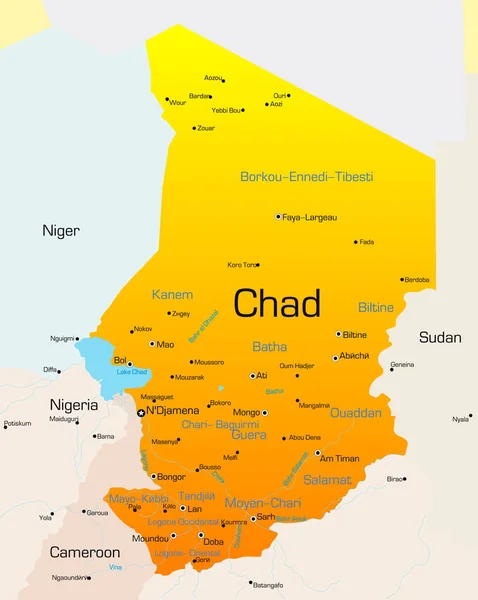
Stock image Chad map. Map with neighboring states and name. Red and orange color illustration.
Published:
Jul.16, 2024 07:26:24
Author:
ranyaartdesign.gmail.com
Views:
0
Downloads:
0
File type:
image
/
jpg
File size:
2.92 MB
Orginal size:
10579
x
6613
px
Available sizes:
S
(500 x 313)
M
(1000 x 625)
L
(2000 x 1250)
XL
(10579 x 6613)
EL0
(10579 x 6613)
Level:
beginner
Download Image
Image topics:
Red
Background
Illustration
Event
Travel
Border
African
World
Town
Outline
Country
Map
Cartography
Geography
National
Africa
Land
Continental
Conflict
State
Strategic
Location
International
Borders
Government
Political
Geographic
Republic
Territory
Nation
Coup
Actuality
Geographical
Nigeria
Niger
Simplified
Cameroon
Sudan
Geopolitical
Golpe
CENTRAL AFRICAN REPUBLIC
Africa Map
Chad Map
Chad Country
Ecowas
Chad Africa
Fall Of Government
Decolonization Of Africa
Chad Coup
Similar stock images
Abstract Vector Color Map Of Chad Country
2691 × 3379
Ryazan, Russia - July 08, 2018: Country Of Chad On The Google Maps Service
5184 × 3456
Chad Highlighted On A White Simplified 3D World Map. Digital 3D Render.
5184 × 2916
Map Of Chad With Capitals In Pastellorange
3825 × 4417
Map Of Chad With Capitals In Pastel Orange
3825 × 4417