Home
Images
Vectors
Videos
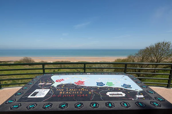
Stock image Coleville Sur Mer Normandy May 6th 2013: Map of the D-Day landing beaches in Normandy, France
Published:
Jul.03, 2018 05:28:48
Author:
Michael6882
Views:
27
Downloads:
1
File type:
image
/
jpg
File size:
11.61 MB
Orginal size:
5760
x
3840
px
Available sizes:
S
(500 x 333)
M
(1000 x 667)
L
(2000 x 1333)
XL
(5760 x 3840)
EL0
(5760 x 3840)
Level:
beginner
Download Image
Image topics:
Background
Day
Sign
Travel
European
Memory
Information
World
American
France
Beach
Coast
Europe
Second
Signboard
Military
History
War
Beaches
Location
Landing
Operation
Memorial
Normandy
Sur
Mer
Omaha
Colleville
Arromanches
Overlord
Vierville
Similar stock images
Oosterschelde, The Netherlands, August 2019. One Of The Access P
4902 × 3247
Houlgate, France, May 2023 Dragon - A Huge Kite In The Shape Of A Dragon Children Helping The Dragon To Fly At The Houlgaten Kite Festival In Normandy
3872 × 2904
The Old Brutalist Coastguard Station In Fleetwood With Radar Antennae With Crass Covered Dunes Leading To The Beach On A Summers Day In Bright Sunlight With Blue Sky
4494 × 3234
Waste Sorting Containers For Recycling In The City Of Gijon In Spain In Front Of San Lorenzzo Beach
6048 × 4024
Omaha Beach As Seen From The American Cemetary At Coleville Sur Mer, Normandy
5760 × 3840
Row Of Wooden Painted Brightly Coloured Beach Huts
5760 × 3840
Sign National Park
2644 × 3874
Oosterschelde, The Netherlands, August 2019. One Of The Access P
4928 × 3264