Home
Images
Vectors
Videos
Stock image Gabon on illustrated globe
Published:
Feb.22, 2017 07:06:56
Author:
tom.griger
Views:
6
Downloads:
4
File type:
image
/
jpg
File size:
15.29 MB
Orginal size:
5000
x
3750
px
Available sizes:
S
(500 x 375)
M
(1000 x 750)
L
(2000 x 1500)
XL
(5000 x 3750)
EL0
(5000 x 3750)
Level:
bronze
Download Image
Image topics:
Red
Illustration
Planet
Country
Map
Africa
Orbit
Borders
Satellite
Gabon
Gabonese
3d Render
Gabonese Republic
Similar stock images
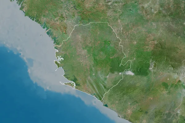
Sierra Leone Area On The Satellite D Map In The Stereographic Projection - Raw Composition Of Raster Layers
2880 × 1620
Congo On Illustrated Globe
5000 × 3750
Extended Area Of Outlined Sierra Leone. Satellite Imagery. 3D Rendering
3000 × 2000
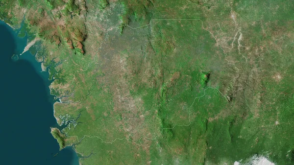
Eastern, Province Of Sierra Leone. Satellite Imagery. Shape Outlined Against Its Country Area. 3D Rendering
2880 × 1620
Guyana On Illustrated Globe
5000 × 3750
Extended Area Of Sierra Leone With Country Outline, International And Regional Borders. Satellite Imagery. 3D Rendering
3000 × 2000
Northern, Province Of Sierra Leone. Satellite Imagery. Shape Outlined Against Its Country Area. 3D Rendering
2880 × 1620
Guinea Area On The Satellite D Map In The Stereographic Projection - Raw Composition Of Raster Layers
2880 × 1620