Home
Images
Vectors
Videos
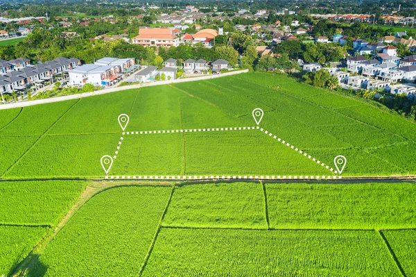
Stock image Land plot in aerial view. Gps registration survey of property, real estate for map with location, area. Concept for residential construction and development. Also home, house for sale, buy, purchase,
Published:
Nov.04, 2022 11:11:52
Author:
roncivil
Views:
2
Downloads:
0
File type:
image
/
jpg
File size:
13.82 MB
Orginal size:
5464
x
3640
px
Available sizes:
S
(500 x 333)
M
(1000 x 666)
L
(2000 x 1332)
XL
(5464 x 3640)
EL0
(5464 x 3640)
Level:
silver
Download Image
Image topics:
Blue
View
Design
Sky
Sale
Business
Buy
Mountain
Line
Symbol
Icon
Building
Construction
Estate
House
Real
Home
Development
Measure
Measurement
Information
Earth
Clouds
Investment
Property
Skyline
Top
Hill
Site
Map
Plan
Area
Land
Residential
Size
Meters
Purchase
Calculator
Sell
Rent
Cost
Lot
Plot
Calculate
Comparison
Survey
Vacant
Identify
Registration
Similar stock images
Land Plot In Aerial View. Real Estate Or Property Consist Of Empty Land Or Green Field And Gps Position Pin Point Of Location For Development By Housing Construction, Sale, Rent, Buy Or Investment.
5464 × 3640
Land Plot In Aerial View. Gps Registration Survey Of Property, Real Estate For Map With Location, Area. Concept For Residential Construction And Development. Also Home, House For Sale, Buy, Purchase.
5464 × 3640
Land Plot In Aerial View. Identify Registration Symbol Of Vacant Area For Map. That Property, Real Estate For Business Of Home, House Or Residential I.e. Construction, Development, Sale, Rent, Buy, Purchase Or Investment.
5464 × 3640
Land Plot In Aerial View. Gps Registration Survey Of Property, Real Estate For Map With Location, Area. Concept For Residential Construction And Development. Also Home, House For Sale, Buy, Investment
5464 × 3640
Land Or Landscape Of Green Field In Aerial View. Include Agriculture Farm, Icon Of Residential, Home Or House Building. Real Estate Or Property For Dream Concept To Build, Construction, Sale And Buy.
5464 × 3640
Land Plot In Aerial View. Identify Registration Symbol Of Vacant Area For Map. That Property, Real Estate For Business Of Home, House Or Residential I.e. Construction, Development, Sale, Rent, Buy.
5464 × 3640
Land Plot In Aerial View. Real Estate Or Property Consist Of Empty Land Or Green Field And Gps Position Pin Point Of Location For Development By Housing Construction, Sale, Rent, Buy Or Investment.
5464 × 3640
Land, House, Residential Area And Satellite In Aerial View. Concept Of Plot On Earth, Map Data, Survey Or Measurement By Gps, System, Technology. Real Estate And Property For Sale, Buy, Development.
5464 × 3640