Home
Images
Vectors
Videos
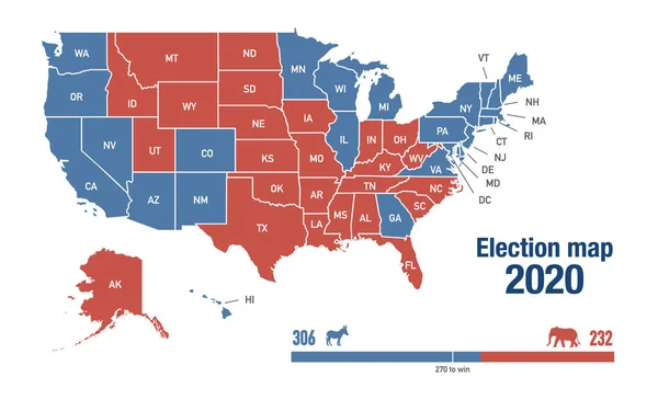
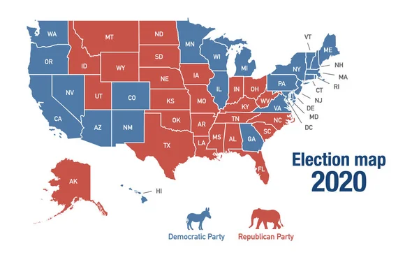
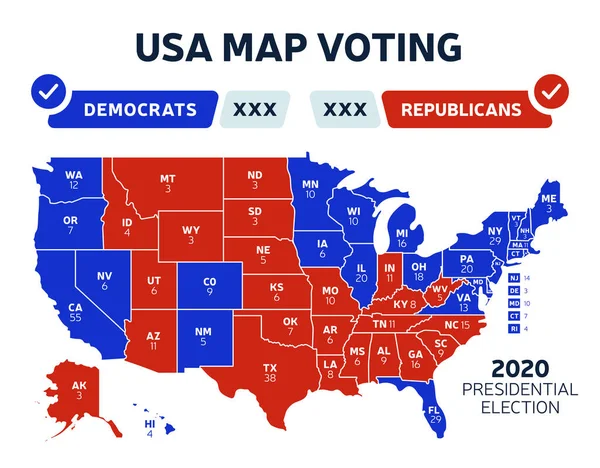
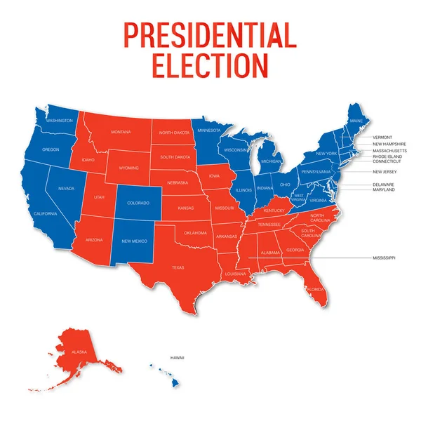
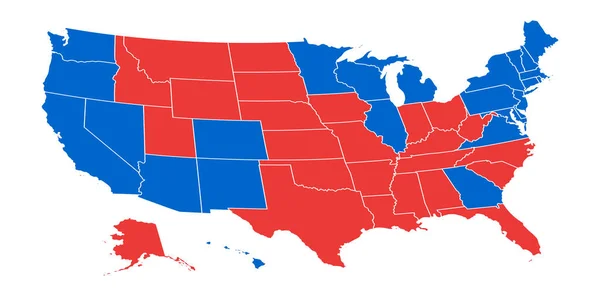
Stock image Map of 2020 USA presidential elections results, illustrated per state
Published:
Nov.13, 2020 15:17:59
Author:
Wirestock
Views:
1
Downloads:
0
File type:
image
/
jpg
File size:
1.2 MB
Orginal size:
3200
x
2000
px
Available sizes:
S
(500 x 313)
M
(1000 x 625)
L
(2000 x 1250)
XL
(3200 x 2000)
EL0
(3200 x 2000)
Level:
platinum
Download Image
Image topics:
Blue
Background
Illustration
Design
Sign
Party
American
Us
Usa
Country
Map
National
Results
America
United
States
Region
Voting
Vote
Candidate
President
Election
Poll
2020
Presidency
Presidential
Similar stock images
Map Of 2020 USA Presidential Elections Results, Illustrated Per State
3200 × 2000
Map Of 2020 USA Presidential Elections Results, Illustrated Per State
3200 × 2000
USA Presidential Election Results Map. Usa Map Voting. Presidential Election Map Each State American Electoral Votes Showing Republicans Or Democrats Political Vector Infographic
7699 × 6018
Presidential Election 2020 Usa With Usa Map In Vector
4000 × 4000
US Election Map. American Presidential Election Results Infographics Template. All The States Are Separated And Named In The Layer Panel.
8192 × 4975
USA Presidential Election Results Map. Usa Map Voting. Presidential Election Map Each State American Electoral Votes Showing Republicans Or Democrats Political Vector Infographic
5998 × 3168
US Election Results Map. American Presidential Election Results
8192 × 4059
USA Presidential Election Results Map. Usa Map Voting. Presidential Election Map Each State American Electoral Votes Showing Republicans Or Democrats Political Vector Infographic
5998 × 3168