Home
Images
Vectors
Videos
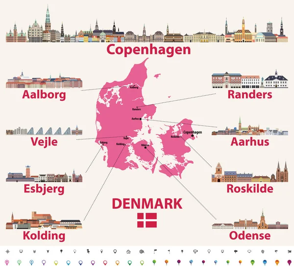
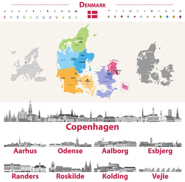
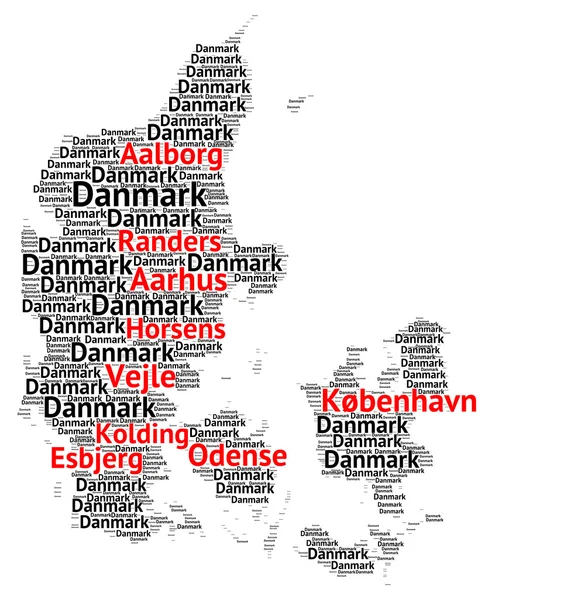
Stock image Map of Denmark with the biggest cities
Published:
Feb.12, 2016 09:40:39
Author:
ricochet69
Views:
115
Downloads:
3
File type:
image
/
jpg
File size:
3.7 MB
Orginal size:
5098
x
5193
px
Available sizes:
S
(491 x 500)
M
(982 x 1000)
L
(1963 x 2000)
XL
(5098 x 5193)
EL0
(5098 x 5193)
Level:
bronze
Download Image
Image topics:
Background
Illustration
Isolated
Shape
Travel
Cloud
European
Border
Symbol
Concept
City
World
Tourism
Capital
Scandinavia
North
Europe
Country
Map
Cartography
Geography
National
Nordic
Word
Denmark
Copenhagen
Biggest
Cities
Scandinavian
Danish
Peninsula
Nation
Jutland
Odense
Aarhus
Funen
Similar stock images
Sketch Denmark Letter Text Map, Denmark - In The Shape Of The Continent, Map Kingdom Of Denmark - Color Vector Illustration
7452 × 4724
Sketch Denmark Letter Text Map, Denmark - In The Shape Of The Continent, Map Kingdom Of Denmark - Brown And Black Vector Illustration
7452 × 4724
Denmark Map In Dot Style With Grunge Name Stamps
5042 × 3175
Denmark Word Cloud With The Biggest Cities
7389 × 4330
Vector Hand Drawn Stylized Map Of Denmark Cities. Travel Illustration. Kingdom Of Denmark Geography Illustration. Europe Map Element
4000 × 4000
Denmark Map With Main Cities Skylines Vector Illustration
8334 × 7678
Danish Skylines In Grayscale Color Palette. Flag And Map Of Denmark
8334 × 8225
2D Polygonal Map Of Denmark With Red Stars
5607 × 3000