Home
Images
Vectors
Videos
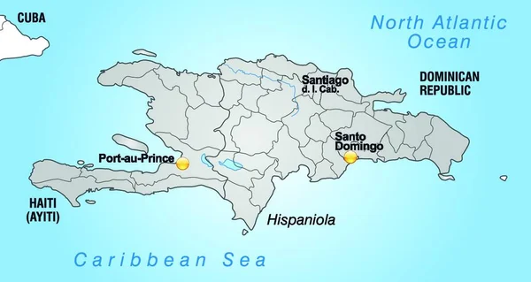
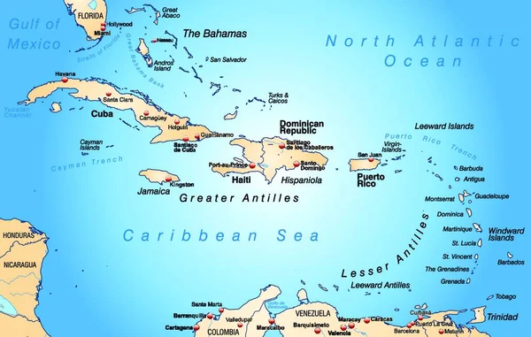
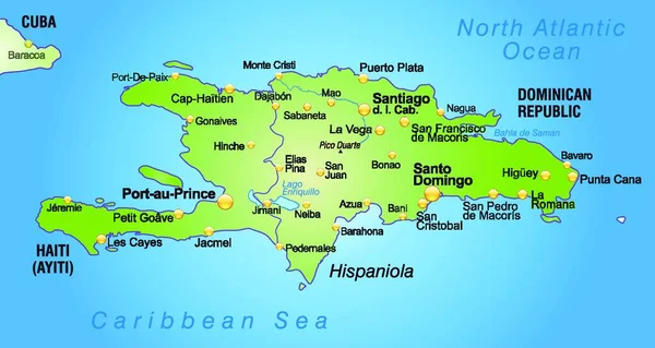
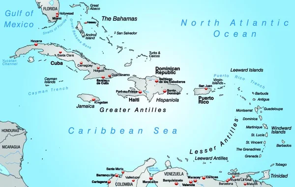
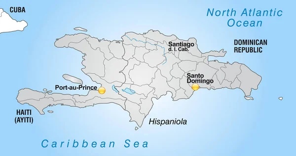
Stock image map of hispaniola with borders in gray
Published:
Feb.25, 2020 10:58:16
Author:
PantherMediaSeller
Views:
6
Downloads:
0
File type:
image
/
jpg
File size:
0 MB
Orginal size:
5486
x
2917
px
Available sizes:
S
(500 x 266)
M
(1000 x 532)
L
(2000 x 1063)
XL
(5486 x 2917)
EL0
(5486 x 2917)
Level:
platinum
Download Image
Image topics:
Illustration
Design
Model
Environment
Border
Card
Gray
Concept
With
Data
Grey
Information
Project
Draft
Map
Cartography
Geography
Plan
Knowledge
America
Borders
Department
Region
Atlas
Milieu
Facts
Informations
Canton
Regions
Haiti
Hispaniola
Map Of The World
Web Design
Substratums
Plan Of Site
Similar stock images
The Card Has A Modern Design And Includes The State Capital,administrative Boundaries And The Water Network ... The Card Can Be Used Immediately And Is Optimized For Printing And Application In Digital Medien..der Color Mode Is Rgb.
4048 × 2152
Map Of West Indies As An Overview Map In Green
5019 × 3189
The Map Is Modern In Design And Contains All The Important Topographical Information
6808 × 4328
The Map Is Modern In Design And Contains All The Important Topographical Information
4048 × 2152
Scenic View Of Traffic Road Infrastructure
6808 × 4328
The Card Is Modern And Contains All Important Topographical Information ... The Card Can Be Used Immediately And Is Optimized For Printing And Application In Digital Medien..der Color Mode Is Rgb.
4048 × 2152
Map Of Antilles As A Map In Pastel Green
5019 × 3189
Vector Illustration On Map On Atlas
6808 × 4328