Home
Images
Vectors
Videos
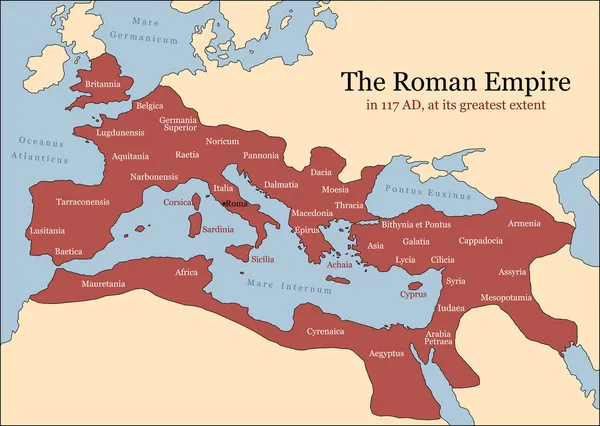
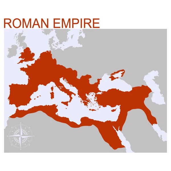
Stock image Map of Roman Empire territory at its peak
Published:
Apr.10, 2023 14:19:19
Author:
dkaramit
Views:
31
Downloads:
0
File type:
image
/
jpg
File size:
1.67 MB
Orginal size:
3200
x
2000
px
Available sizes:
S
(500 x 313)
M
(1000 x 625)
L
(2000 x 1250)
XL
(3200 x 2000)
EL0
(3200 x 2000)
Level:
beginner
Download Image
Image topics:
Illustration
Sea
Culture
Italian
Ancient
Peak
Military
Map
Cartography
Geography
History
Mediterranean
Size
Topography
Empire
Roma
Roman
Rome
Emperor
Largest
Ad
Mare
Territory
Arabia
Macedonia
Britannia
Germania
Trajan
Provinces
Territories
Iberia
Nostrum
Aquitania
Dacia
Mesopotamia
Lusitania
Thracia
Infographic
Judaea
Bélgica
Pontus
Internum
117
Lugdunensis
Terraconensis
Similar stock images
Roman Empire
8438 × 6000
Roman Empire Provinces
8438 × 6000
Map Of The Byzantine Empire At Its Greatest Extent In 565 AD
3200 × 2000
The Empire, Route And Battles Of Alexander The Great From Greece To India
3200 × 2000
The Empire, Route And Battles Of Alexander The Great From Greece To India
3200 × 2000
Vector Map Of The Roman Empire
4000 × 4000
Vector Map Of The Division Of The Roman Empire
4000 × 4000
Vector Map Of The Western Roman Empire
4000 × 4000