Home
Images
Vectors
Videos
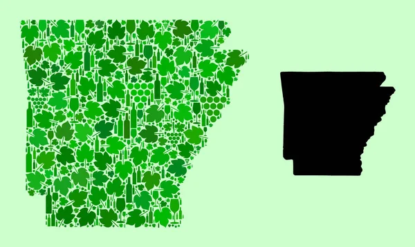
Stock image Map of the American state of Arkansas in the United States of America
Published:
Mar.26, 2019 09:50:42
Author:
agphotography
Views:
0
Downloads:
0
File type:
image
/
jpg
File size:
5.39 MB
Orginal size:
3508
x
2480
px
Available sizes:
S
(500 x 353)
M
(1000 x 707)
L
(2000 x 1414)
XL
(3508 x 2480)
EL0
(3508 x 2480)
Level:
bronze
Download Image
Image topics:
White
Background
Graphic
Element
Design
Set
Isolated
Shape
Sign
Art
Travel
Little
Border
Flag
Symbol
Concept
Icon
Flat
Culture
American
Usa
Rock
Collection
Country
Map
Continent
Made
State
America
United
Official
Isometric
Arkansas
3d Rendering
Similar stock images
Topographic Military Radar Tactical Map Of The Federal State Of Iowa, USA With Emerald Green Contour Lines On Dark Green Background
6000 × 4100
San Juan County, State Of Utah (U.S. County, United States Of America, USA, U.S., US) Map Vector Illustration, Scribble Sketch San Juan Map
7087 × 4726
Holmes County, Florida (U.S. County, United States Of America,USA, U.S., US) Map Vector Illustration, Scribble Sketch Holmes Map
7087 × 4726
Map Of Arkansas State - Mosaic Of Wine And Grapes
5025 × 3000
Topographic Relief Peaks And Valleys Map Of US Federal State Of Arkansas
4800 × 3600
Topographic Relief Peaks And Valleys Map Of US Federal State Of Iowa
4800 × 3600
Kittson County, Minnesota (U.S. County, United States Of America, USA, U.S., US) Map Vector Illustration, Scribble Sketch Kittson Map
7087 × 4726
Topographic Relief Peaks And Valleys Map Of US Federal State Of Nebraska
4800 × 3600