Home
Images
Vectors
Videos
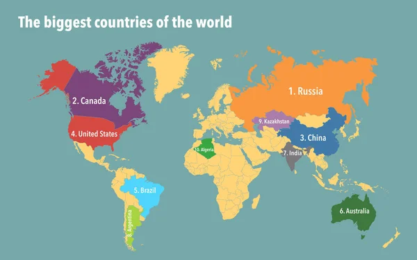
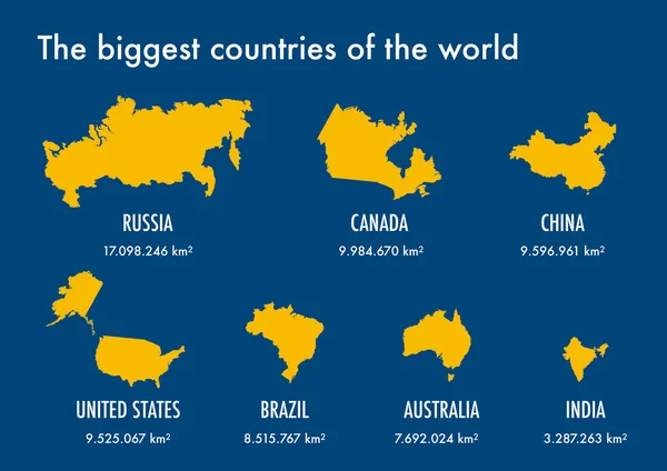
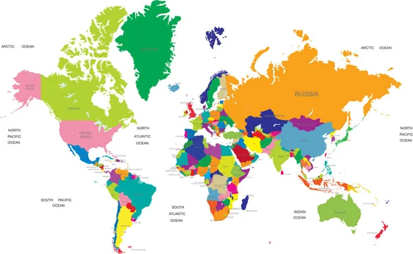
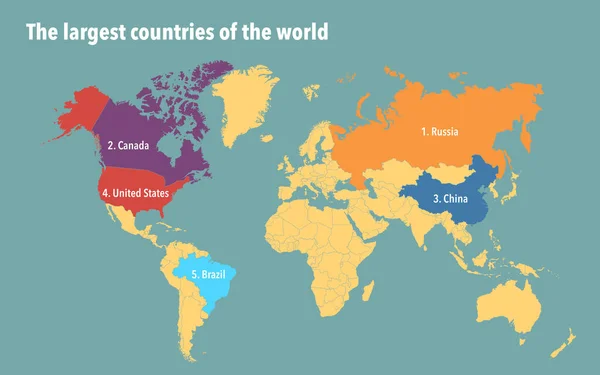
Stock image Map of the biggest countries of the world by total area
Published:
Apr.05, 2023 14:20:47
Author:
dkaramit
Views:
31
Downloads:
0
File type:
image
/
jpg
File size:
1.6 MB
Orginal size:
3200
x
2000
px
Available sizes:
S
(500 x 313)
M
(1000 x 625)
L
(2000 x 1250)
XL
(3200 x 2000)
EL0
(3200 x 2000)
Level:
beginner
Download Image
Image topics:
Water
Colour
Earth
World
Europe
Globe
China
Russia
Top
Country
Map
Cartography
Area
Algeria
Land
Powerful
Order
Asia
Ten
America
Countries
Australia
Borders
Canada
India
Statistics
States
Biggest
Largest
Brazil
Boundaries
Kazakhstan
Argentina
Ranked
Infographic
United States
Top 10
Similar stock images
Map Of The Biggest Countries Of The World By Total Area
3200 × 2000
The Biggest Countries In The World
2970 × 2100
World Population On Political Map With Scale, Borders And Countries
6000 × 4000
Continents Of The World, Map
8268 × 5588
World Map Divided Into Six Continents In Different Color. World Map 6 Continents Isolated On White Background. Vector Stock
5883 × 3538
World Map Divided Into Six Continents In Different Color. Colored Map Of The World With Countries Borders. Vector Stock
5000 × 3372
World Map Divided Into Six Continents In Different Color. World Map 6 Continents Isolated On White Background. Vector Stock
6000 × 3424
This Is A Test Description, Dont Review
3207 × 1973