Home
Images
Vectors
Videos
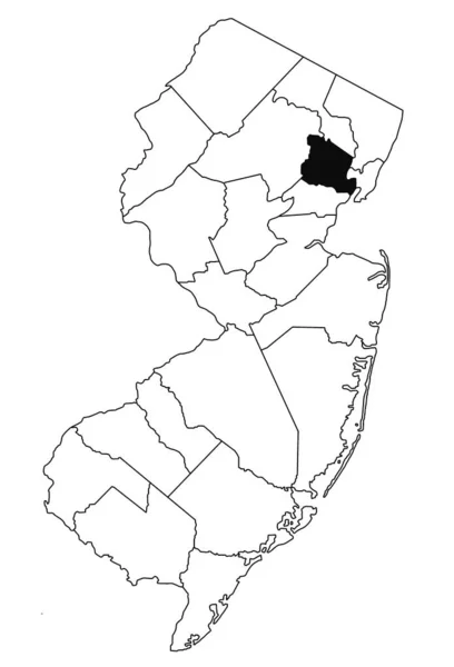
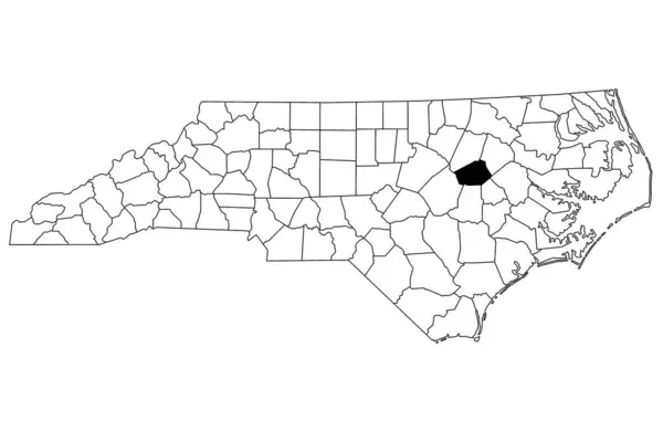
Stock image Map of Wilson County in North Carolina state on white background. single County map highlighted by black color on North Carolina map. UNITED STATES, US
Published:
Jul.18, 2024 06:35:38
Author:
akhtaransari
Views:
0
Downloads:
0
File type:
image
/
jpg
File size:
4.32 MB
Orginal size:
8000
x
5334
px
Available sizes:
S
(500 x 333)
M
(1000 x 667)
L
(2000 x 1334)
XL
(8000 x 5334)
EL0
(8000 x 5334)
Level:
beginner
Download Image
Image topics:
White
Background
Illustration
Design
Isolated
Shape
Single
Abstract
Black
Line
Silhouette
Border
Symbol
City
Blank
Contour
Simple
Drawing
Us
Coastline
Outline
District
Map
Cartography
Geography
Area
State
Location
America
Ceremonial
Government
Political
Administrative
Region
Wise
Maps
Highlighted
Province
County
Locator
Borough
Mapping
Towns
Districts
Wilson
Counties
North Carolina
United States
North Carolina Map
Wilson Map
Similar stock images
Map Of South Carolina, Geographical Map Illustration
5000 × 4000
Map Of North Carolina
5000 × 4000
State Of North Carolina Map
4300 × 2800
Map Of Essex County In New Jersey State On White Background. Single County Map Highlighted By Black Colour On New Jersey Map .
5499 × 8080
Shape Of North Carolina, State Of Mainland United States, With Its Capital Isolated On White Background. Colored Elevation Map. 3D Rendering
3836 × 1800
Map Of Union County In New Jersey State On White Background. Single County Map Highlighted By Black Colour On New Jersey Map .
5499 × 8080
Map Of Mercer County In New Jersey State On White Background. Single County Map Highlighted By Black Colour On New Jersey Map .
5499 × 8080
Shape Of North Carolina, State Of Mainland United States, With Its Capital Isolated On White Background. Bilevel Elevation Map. 3D Rendering
3836 × 1800