Home
Images
Vectors
Videos
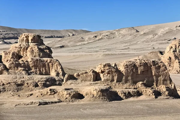
Stock image NW-SE alignment of yardangs-elongated streamlined landforms carved in tectonically folded sedimentary rocks by wind erosion near Nnal.Highway G315 crossing Qaidam basin desert. Qinghai province-China.
Published:
Apr.28, 2020 07:57:43
Author:
rweisswald
Views:
8
Downloads:
1
File type:
image
/
jpg
File size:
19.5 MB
Orginal size:
5400
x
3600
px
Available sizes:
S
(500 x 333)
M
(1000 x 667)
L
(2000 x 1333)
XL
(5400 x 3600)
EL0
(5400 x 3600)
Level:
bronze
Download Image
Image topics:
Weathered
Carved
Dry
China
Sand
Flank
Compact
Desert
Clay
Parallel
Sandstone
Gravel
Grooved
Arid
Fluted
Scraped
Sculpted
Furrow
Sandblast
Weathering
Streamlined
Bedrock
Silt
Deflation
Dirt Road
Sedimentary Rock
Sand Drift
Steep Bank
Saltation
Tire Track
Loose Material
Wind Erosion
Snow Covered Mountain
Qinghai Province
Flying Sand
Erodible
Hard Surface
Aeolian Process
Kunlun Mountains
Qaidam Basin
Ship Like Shape
Particle Abrasion
Meso Yardang
Yardang Field
Haixi Prefecture
Erosional Landform
Elongated Ridge
Eroded Relief
Qimantag Range
Snowcapped Summit
Similar stock images
Morning Light On The Gebel El Gunna
4272 × 2848
NW-SE Alignment Of Yardangs-elongated Streamlined Landforms Carved In Tectonically Folded Sedimentary Rocks By Wind Erosion Near Nnal.Highway G315 Crossing Qaidam Basin Desert. Qinghai Province-China.
5400 × 3600
NW-SE Alignment Of Yardangs-elongated Streamlined Landforms Carved In Tectonically Folded Sedimentary Rocks By Wind Erosion Near Nnal.Highway G315 Crossing Qaidam Basin Desert. Qinghai Province-China.
5400 × 3600
Desert Landscape In Egypt. White Desert In Egypt (Farafra). White Stones And Yellow Sands.
5095 × 3506
The Ruins Of Guge Kingdom.Tuolin, Zanda County, Tibet, China.
5472 × 3648
A Low-angle Shot Of Cliffs In Zanda County Of Ali Prefecture In Tibet, China
5472 × 3648
View Of The North America Nature
3721 × 2480