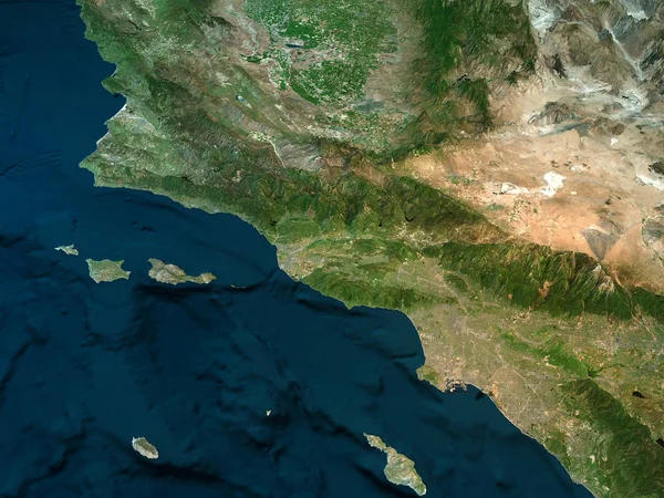
Stock image Physical map of California, Los Angeles mountains, ocean and hills, mountain ranges and fault of Sant'Andrea, 3d render
Published: Sep.18, 2017 11:02:13
Author: vampy1
Views: 95
Downloads: 5
File type: image / jpg
File size: 13.14 MB
Orginal size: 4724 x 3543 px
Available sizes:
Level: silver
Similar stock images


Mexico Area On The Satellite C Map In The Stereographic Projection - Raw Composition Of Raster Layers
2880 × 1620
Centre, Department Of Haiti. Satellite Imagery. Shape Outlined Against Its Country Area. 3D Rendering
2880 × 1620

Tacna, Region Of Peru. Satellite Imagery. Shape Outlined Against Its Country Area. 3D Rendering
2880 × 1620