Home
Images
Vectors
Videos
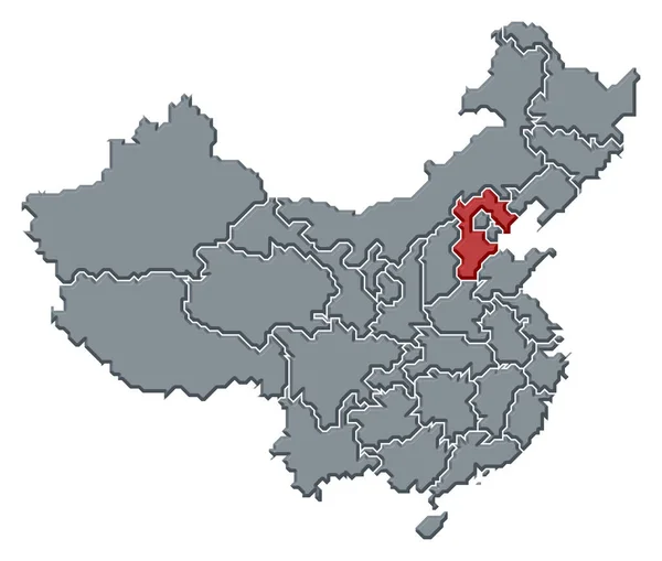
Stock image Political map of China with the several provinces where Tianjin is highlighted.
Published:
Mar.12, 2020 12:00:27
Author:
PantherMediaSeller
Views:
1
Downloads:
0
File type:
image
/
jpg
File size:
0 MB
Orginal size:
6220
x
5276
px
Available sizes:
S
(500 x 424)
M
(1000 x 848)
L
(2000 x 1696)
XL
(6220 x 5276)
EL0
(6220 x 5276)
Level:
platinum
Download Image
Image topics:
Colours
Color
Colors
Colorful
Graphic
Colored
Colour
Colourful
Border
3d
Contour
China
Country
Cartography
Geography
Area
Asia
General
Coloured
Countries
Borders
Frontier
Atlas
Emphasize
Contours
Areas
Grau
Bunt
Frontiers
Farbig
Grafik
Asien
FARBEN
Farbe
Fläche
Einfach
Dreidimensional
Geografie
Gebiet
Bundesland
Bundesländer
Bundeslaender
General Map
General Maps
Flaeche
Einteilung
Flächen
Gebiete
Flaechen
Chinakarte
Similar stock images
Political Map Of China With The Several Provinces Where Beijing Is Highlighted.
6220 × 5276
Political Map Of China With The Several Provinces Where Anhui Is Highlighted.
6220 × 5276
Political Map Of China With The Several Provinces Where Liaoning Is Highlighted.
6220 × 5276
Political Map Of China With The Several Provinces Where Shanxi Is Highlighted.
6220 × 5276
Political Map Of China With The Several Provinces Where Hebei Is Highlighted.
6220 × 5276
Political Map Of China With The Several Provinces Where Chongqing Is Highlighted.
6220 × 5276
Political Map Of China With The Several Provinces Where Ningxia Is Highlighted.
6220 × 5276
Political Map Of China With The Several Provinces Where Hubei Is Highlighted.
6220 × 5276