photo free
Home Images Vectors Videos

Stock image Political map of Netherlands with the several states where North Holland is highlighted.

Stock image Political map of Netherlands with the several states where North Holland is highlighted.
Published: Apr.15, 2020 09:32:18
Author: PantherMediaSeller
Views: 0
Downloads: 0
File type: image / jpg
File size: 0 MB
Orginal size: 4449 x 5000 px
Available sizes:
S
(445 x 500)
M
(890 x 1000)
L
(1780 x 2000)
XL
(4449 x 5000)
EL0
(4449 x 5000)
Level: platinum
Download Image
Image topics:

Similar stock images

stock image Political map of Netherlands with the several states.

Political Map Of Netherlands With The Several States.

4449 × 5000
stock image Political map of Netherlands with the several states.

Political Map Of Netherlands With The Several States.

4449 × 5000
stock image Netherlands country

Netherlands Country

6701 × 8001
stock image Political map of Netherlands with the several states where South Holland is highlighted.

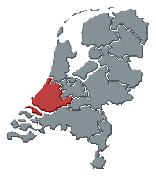
Political Map Of Netherlands With The Several States Where South Holland Is Highlighted.

4449 × 5000
stock vector Netherlands provinces map

Netherlands Provinces Map

4324 × 5000
stock image Political map of Netherlands with the several states where North Brabant is highlighted.

Political Map Of Netherlands With The Several States Where North Brabant Is Highlighted.

4449 × 5000
stock vector Gray Provinces Map of European Country of Netherlands

Gray Provinces Map Of European Country Of Netherlands

3600 × 4800
stock image Political map of Netherlands with the several states where Overijssel is highlighted.

Political Map Of Netherlands With The Several States Where Overijssel Is Highlighted.

4449 × 5000