Home
Images
Vectors
Videos
Stock image Ryazan, Russia - July 08, 2018: Country of Algeria on the google maps service
Published:
Oct.05, 2018 15:54:05
Author:
sharafmaksumov
Views:
3
Downloads:
0
File type:
image
/
jpg
File size:
9.3 MB
Orginal size:
5184
x
3456
px
Available sizes:
S
(500 x 333)
M
(1000 x 667)
L
(2000 x 1333)
XL
(5184 x 3456)
EL0
(5184 x 3456)
Level:
bronze
Download Image
Image topics:
Color
Background
Graphic
Travel
City
Screen
Monitor
Pc
Contour
World
Globe
Country
Map
Geography
Algeria
Continent
Land
Editorial
Topography
Political
Atlas
Illustrative
Google Maps
Similar stock images
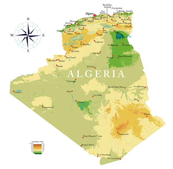
Highly Detailed Physical Map Of Algeria In Vector Format,with All The Relief Forms,regions And Big Cities.
7500 × 7316
Ryazan, Russia - July 08, 2018: Country Of Algeria On The Google Maps Service
5184 × 3456
Precipitation Of Driest Quarter Within The Iraq Area In The Stereographic Projection With Legend - Main Composition
2880 × 1620
Precipitation Of Warmest Quarter Within The Iraq Area In The Stereographic Projection With Legend - Main Composition
2880 × 1620
Egypt Extruded On The Satellite Orthographic Map. Capital, Administrative Borders And Graticule
3840 × 2160
Precipitation Of Driest Quarter Within The Iraq Area In The Stereographic Projection With Legend - Raw Composition Of Raster Layers With Light Glowing Outline
2880 × 1620
Ryazan, Russia - July 08, 2018: Country Of Algeria On The Google Maps Service
5184 × 3456