Home
Images
Vectors
Videos
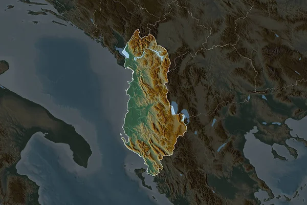
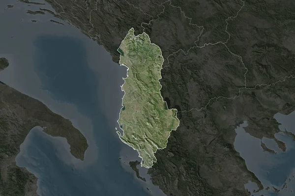
Stock image Shape of Albania separated by the desaturation of neighboring areas. Satellite imagery. 3D rendering
Published:
Aug.18, 2020 11:58:51
Author:
Yarr65
Views:
0
Downloads:
0
File type:
image
/
jpg
File size:
5.21 MB
Orginal size:
3000
x
2000
px
Available sizes:
S
(500 x 333)
M
(1000 x 667)
L
(2000 x 1333)
XL
(3000 x 2000)
EL0
(3000 x 2000)
Level:
bronze
Download Image
Image topics:
View
Travel
Nature
Sea
Landscape
Earth
Planet
World
Ocean
Science
Capital
Europe
Globe
Profile
Country
Map
Cartography
Geography
Continent
Land
Zoom
Satellite
Region
Territory
Atlas
Overlay
Albania
Tirana
Alb
3d Rendering
Subregion
Administrative Division
Similar stock images
Shape Of Albania Separated By The Desaturation Of Neighboring Areas. Borders. Satellite Imagery. 3D Rendering
3000 × 2000
Zoom In On Vlore (county Of Albania) Extruded. Oblique Perspective. Topographic Relief Map With Surface Waters. 3D Rendering
3840 × 2160
Zoom In On Trat (province Of Thailand) Outlined. Oblique Perspective. Satellite Imagery. 3D Rendering
3840 × 2160
Toscana, Region Of Italy. Satellite Imagery. Shape Outlined Against Its Country Area. 3D Rendering
2880 × 1620
Croatia Outlined - High Resolution Satellite Image
2880 × 1620
Shape Of Albania Separated By The Desaturation Of Neighboring Areas. Borders. Topographic Relief Map. 3D Rendering
3000 × 2000
Albania Area On The Satellite A Map In The Stereographic Projection - Raw Composition Of Raster Layers With Dark Glowing Outline
2880 × 1620
Albania Area On The Satellite D Map In The Stereographic Projection - Raw Composition Of Raster Layers With Dark Glowing Outline
2880 × 1620