Home
Images
Vectors
Videos
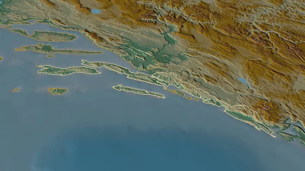
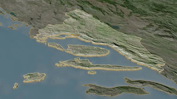
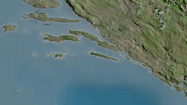
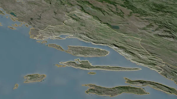
Stock image Splitsko-Dalmatinska, county of Croatia. Satellite imagery. Shape outlined against its country area. 3D rendering
Published:
Sep.16, 2020 09:34:44
Author:
Yarr65
Views:
0
Downloads:
0
File type:
image
/
jpg
File size:
4.58 MB
Orginal size:
2880
x
1620
px
Available sizes:
S
(500 x 281)
M
(1000 x 563)
L
(2000 x 1125)
XL
(2880 x 1620)
EL0
(2880 x 1620)
Level:
bronze
Download Image
Image topics:
View
Shape
Travel
Nature
Border
Landscape
Glow
Contour
Scale
Earth
Planet
World
Ocean
Science
Capital
Europe
Profile
Outline
Country
Map
Cartography
Geography
Continent
Land
Zoom
Split
Satellite
Region
Croatia
Territory
Outlined
Atlas
County
Legend
Overlay
Zagreb
3d Rendering
Subregion
Hrv
Splitsko Dalmatinska
Administrative Division
Split Dalmacia
Similar stock images
Dubrovacko-Neretvanska, County Of Croatia. Satellite Imagery. Shape Outlined Against Its Country Area. 3D Rendering
2880 × 1620
Zoom In On Splitsko-Dalmatinska (county Of Croatia) Outlined. Oblique Perspective. Satellite Imagery. 3D Rendering
3840 × 2160
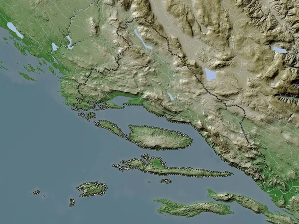
Splitsko-Dalmatinska, County Of Croatia. Elevation Map Colored In Wiki Style With Lakes And Rivers
3840 × 2880
Zoom In On Dubrovacko-Neretvanska (county Of Croatia) Outlined. Oblique Perspective. Topographic Relief Map With Surface Waters. 3D Rendering
3840 × 2160
Western Greece, Decentralized Administration Of Greece. Satellite Imagery. Shape Outlined Against Its Country Area. 3D Rendering
2880 × 1620
Western Greece, Decentralized Administration Of Greece. Elevation Map Colored In Wiki Style With Lakes And Rivers
3840 × 2880
Shape Of Albania Separated By The Desaturation Of Neighboring Areas. Satellite Imagery. 3D Rendering
3000 × 2000
Zoom In On Splitsko-Dalmatinska (county Of Croatia) Extruded. Oblique Perspective. Satellite Imagery. 3D Rendering
3840 × 2160