Home
Images
Vectors
Videos
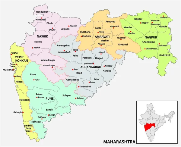
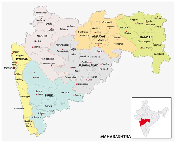
Stock vector administrative and political map of indian state of Maharashtra, india
Published:
Jan.02, 2019 21:06:04
Author:
Lesniewski
Views:
266
Downloads:
4
File type:
vector
/
eps
File size:
1.46 MB
Orginal size:
3794
x
3100
px
Available sizes:
S
(500 x 409)
M
(1000 x 817)
L
(2000 x 1634)
XL
(3794 x 3100)
VECT
(3794 x 3100)
EL0
(3794 x 3100)
Level:
bronze
Download Vector
Vector topics:
White
Vector
Background
Graphic
Illustration
Design
Isolated
Shape
Art
Travel
Colour
Pattern
Sea
Silhouette
Border
Symbol
Concept
City
Communication
Contour
Grey
Simple
Globe
Outline
Country
Map
Cartography
Geography
Area
Asia
State
Political
Administrative
India
Maharashtra
Region
Indian
Maps
Highlighted
Mapping
Districts
Nadu
Outline Map
Similar stock vectors
Administrative And Political Map Of Indian State Of Maharashtra, India
4000 × 3878
Telangana Red Highlighted In Map Of India
5800 × 6334
Goa Red Highlighted In Map Of India
5800 × 6334
Andhra Pradesh Red Highlighted In Map Of India
5800 × 6334
Haryana Red Highlighted In Map Of India
5800 × 6334
Gujarat Red Highlighted In Map Of India
5800 × 6334
Arunachal Pradesh Red Highlighted In Map Of India
5800 × 6334
Karnataka Red Highlighted In Map Of India
5800 × 6334