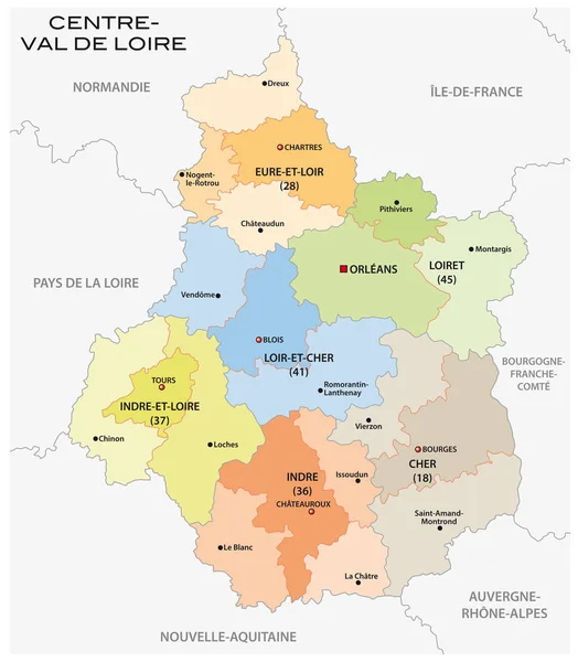
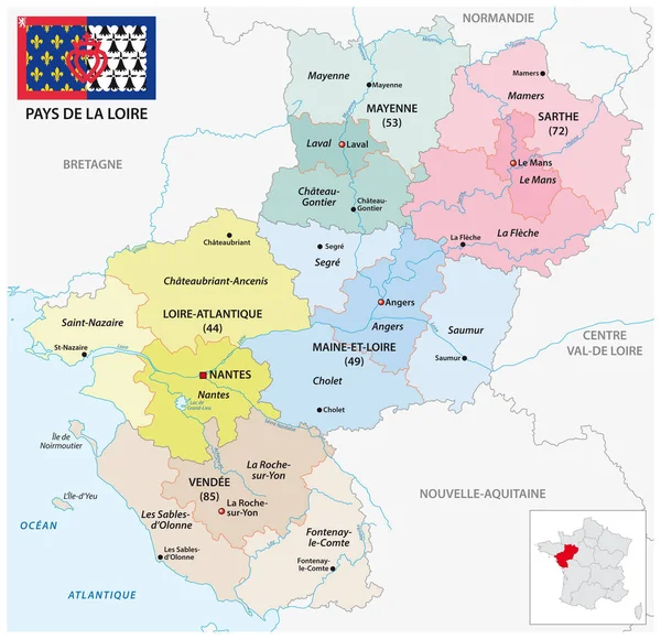
Stock vector Administrative vector map of the French region of Pays de la Loire with flag
Published: Aug.09, 2021 14:00:40
Author: Lesniewski
Views: 14
Downloads: 3
File type: vector / eps
File size: 1.76 MB
Orginal size: 3206 x 3100 px
Available sizes:
Level: bronze