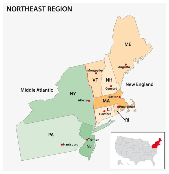
Stock vector Administrative vector map of the US Census Region Northeast
Published: Jul.25, 2022 07:02:06
Author: Lesniewski
Views: 5
Downloads: 2
File type: vector / eps
File size: 0.71 MB
Orginal size: 3100 x 3187 px
Available sizes:
Level: bronze
Similar stock vectors

High Quality Map Of Northeast Region Of United States Of America With Borders Of The States
4000 × 4000
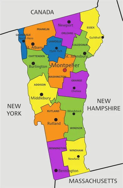
Colorful Vermont Political Map With Clearly Labeled, Separated Layers. Vector Illustration.
3229 × 4922