Home
Images
Vectors
Videos
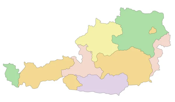
Stock vector Austria - Highly detailed editable political map with separated layers.
Published:
Feb.02, 2022 08:57:26
Author:
delpieroo
Views:
2
Downloads:
0
File type:
vector
/
eps
File size:
5.24 MB
Orginal size:
5670
x
3300
px
Available sizes:
S
(500 x 291)
M
(1000 x 582)
L
(2000 x 1164)
XL
(5670 x 3300)
VECT
(5670 x 3300)
EL0
(5670 x 3300)
Level:
bronze
Download Vector
Vector topics:
Green
Vector
Background
Colored
Illustration
Label
Travel
Sea
European
Road
Pastel
City
Contour
Capital
Europe
South
Outline
Country
German
Map
Cartography
Geography
National
Germany
Land
Topography
Islam
Political
Alps
Politics
Union
Geographic
Eu
Vienna
Editable
Territory
Atlas
Austria
Austrian
Danube
Mapping
Innsbruck
Rivers
Shaded
Refugee
Salzburg
Graz
Klagenfurt
Similar stock vectors
Highly Detailed Editable Political Map With Separated Layers. Slovakia.
2921 × 1478
Highly Detailed Editable Political Map With Separated Layers. Lithuania.
3000 × 2267
Highly Detailed Editable Political Map With Separated Layers. Latvia.
3000 × 1915
Highly Detailed Editable Political Map With Separated Layers. Czech Republic.
5305 × 3010
Highly Detailed, Editable Political Map With Separated Layers. Switzerland.
5670 × 3819
Austria - Highly Detailed Editable Political Map.
5670 × 3300
Lombardy, Lombardia, Italy Vector Map Illustration Isolated On White Background. Lombardy Province With Separated Regions.
5181 × 4710
Highly Detailed Editable Political Map With Separated Layers. Belgium.
5404 × 4252