Home
Images
Vectors
Videos
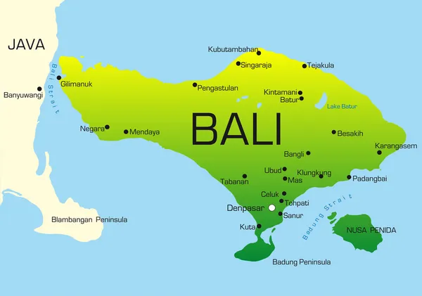
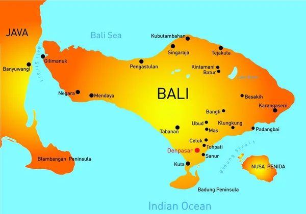
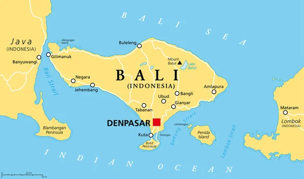
Stock vector Bali political map, with capital Denpasar. A province and island of Indonesia, westernmost of Lesser Sunda Islands, east of Java, west of Lombok. The only Hindu-majority province in Indonesia. Vector.
Published:
Apr.22, 2021 06:55:45
Author:
Furian
Views:
401
Downloads:
2
File type:
vector
/
eps
File size:
2.3 MB
Orginal size:
9000
x
5297
px
Available sizes:
S
(500 x 294)
M
(1000 x 589)
L
(2000 x 1177)
XL
(9000 x 5297)
VECT
(9000 x 5297)
EL0
(9000 x 5297)
Level:
silver
Download Vector
Vector topics:
Vector
Illustration
Travel
Tourism
Capital
Country
Map
Cartography
Geography
Asia
Island
Political
Java
Islands
Strait
Atlas
Peninsula
Province
Hindu
Indonesia
Lesser
Mapping
Bali
Majority
Penida
Ubud
Kuta
Bukit
Denpasar
Batur
Lombok
Tabanan
Negara
Indian Ocean
Sunda
Amlapura
Gilimanuk
Mount Batur
Banyuwangi
Badung
Lake Batur
Sunda Islands
Bali Sea
Bali Map
Buleleng
Bukit Peninsula
Bangli
Badung Strait
Blambangan
Similar stock vectors
Bali, Gray Political Map. A Province And Island Of Indonesia, The Westernmost Of Lesser Sunda Islands, East Of Java, West Of Lombok. The Only Hindu-majority Province In Indonesia. Illustration. Vector
9000 × 5297
Bali Map
3461 × 2184
Bali
5290 × 3719
Road Vector Map Of The Indonesian Island Of Bali
4394 × 3100
Indonesia Political Map
9000 × 4554
Bali Country Map, Web Simple Illustration
5000 × 3518
Map Of Indonesia - Highly Detailed Vector Illustration
6882 × 3144