Home
Images
Vectors
Videos
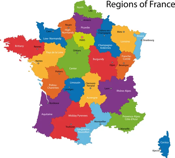
Stock vector Beautiful and colorful detailes map of France with french islands, new regions and capitals. French names. Vector illustration III.
Published:
Mar.15, 2018 13:25:55
Author:
Albachiaraa
Views:
1035
Downloads:
10
File type:
vector
/
eps
File size:
2.42 MB
Orginal size:
5000
x
4462
px
Available sizes:
S
(500 x 446)
M
(1000 x 892)
L
(2000 x 1785)
XL
(5000 x 4462)
VECT
(5000 x 4462)
EL0
(5000 x 4462)
Level:
silver
Download Vector
Vector topics:
Vector
Colorful
Illustration
Sign
Travel
Sea
French
Border
Symbol
Icon
Education
Multicolored
France
Ocean
Tourism
Capital
Europe
Name
Country
District
Map
Cartography
Geography
Continent
Mediterranean
State
Language
Island
Government
Political
Administrative
Atlantic
Politics
Dom
Department
Region
Federal
Tom
Administration
Frontier
Nation
Polynesia
County
Regional
Reunion
Corsica
Guyana
Martinique
Guadeloupe
Borderland
Similar stock vectors
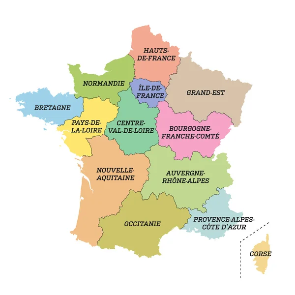
Beautiful And Colorful Map Of France With New Regions And Capitals. Vector Illustration.
4875 × 4875
Beautiful And Colorful Map Of France With New Regions And Capitals. Vector Illustration II.
4875 × 4875
Colorful France Map
5202 × 4706
France Metropolitan Map With New Regions
8000 × 8000
France - Map Of Metropolitan Regions
6000 × 6000
The Detailed Map Of The France With Regions Or States And Cities, Capital
5000 × 5000
Normandie Red Highlighted In Map Of France
5908 × 5100
Normandie Red Highlighted In Map Of France
7531 × 6500