Home
Images
Vectors
Videos
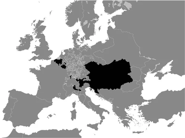
Stock vector Black Flat Map of Poland-Lithuania (year 1714) inside Gray Map of European Continent
Published:
Nov.23, 2020 09:03:07
Author:
momcilo.jovanov
Views:
2
Downloads:
0
File type:
vector
/
eps
File size:
14.08 MB
Orginal size:
4800
x
3600
px
Available sizes:
S
(500 x 375)
M
(1000 x 750)
L
(2000 x 1500)
XL
(4800 x 3600)
VECT
(4800 x 3600)
EL0
(4800 x 3600)
Level:
bronze
Download Vector
Vector topics:
Color
White
Vector
Background
Graphic
Illustration
Design
Isolated
Shape
Sign
Art
Travel
Abstract
European
Border
Flag
Banner
Symbol
Concept
Icon
City
Contour
Earth
World
Europe
Outline
Country
Map
Cartography
Geography
National
Continent
State
Emblem
Patriotism
Political
Administrative
Republic
Eu
Official
Region
Patriotic
Province
Nation
Similar stock vectors
Black Flat Map Of German Reich (year 1939) Inside Gray Map Of Europe
4800 × 3600
Black Flat Map Of North German Confederation (1867) Inside Gray Map Of Europe
4800 × 3600
Black Flat Map Of Habsburg Monarchy (1789) Inside Grey Map Of Europe
4800 × 3600
Black Flat Map Of Francia (year 814) Inside Gray Map Of Europe
4800 × 3600
Black Flat Map Of German Confederation (1815) Inside Gray Map Of Europe
4800 × 3600
Black Flat Map Of Habsburg Monarchy (1714) Inside Grey Map Of Europe
4800 × 3600
Black Flat Map Of Holy Roman Empire (year 1097) Inside Gray Map Of Europe
4800 × 3600
Black Flat Map Of Kingdom Of Prussia (year 1789) Inside Gray Map Of European Continent
4800 × 3600