Home
Images
Vectors
Videos
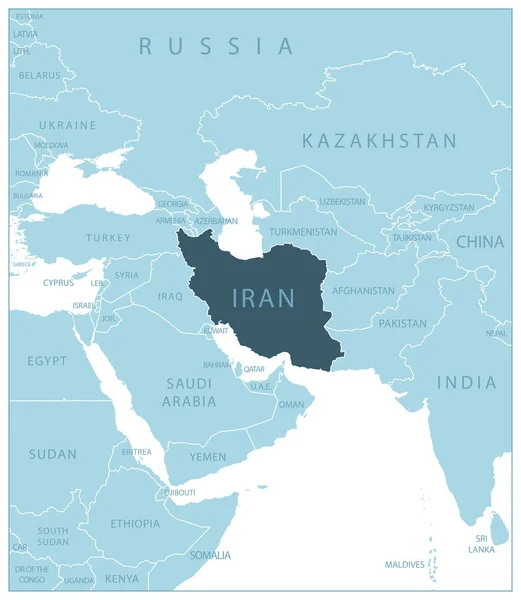
Stock vector Blue-gray detailed map of Iran and administrative divisions and location on the globe.
Published:
Apr.10, 2020 06:49:58
Author:
gt29
Views:
13
Downloads:
0
File type:
vector
/
eps
File size:
15.61 MB
Orginal size:
5258
x
5252
px
Available sizes:
S
(500 x 499)
M
(1000 x 999)
L
(2000 x 1998)
XL
(5258 x 5252)
VECT
(5258 x 5252)
EL0
(5258 x 5252)
Level:
bronze
Download Vector
Vector topics:
White
Blue
Vector
Background
Set
Business
Travel
Abstract
Pattern
Border
Weather
3d
Gray
Icon
Shadow
Earth
Planet
World
Tourism
Globe
East
Collection
Sheet
Country
Map
Cartography
Geography
Continent
Separation
Asia
State
Islam
Political
Marker
Separated
Tehran
Shiraz
Hemisphere
Iran
Provinces
Territories
Blue Gray
Municipalities
Middle East
Iran Map
Administrative Divisions
Islamic Republic
Mashhad Tabriz
Similar stock vectors
Iran Map - Detailed Vector Illustration
5500 × 5501
Map Of Iran - Highly Detailed Vector Illustration
5702 × 5702
Turkmenistan Physiography Map
4490 × 4145
Iran Map - Detailed Vector Illustration
5500 × 5501
Iran - Blue Map With Neighboring Countries And Names. Vector Illustration
5261 × 6051
Iran Political Map
9033 × 6997
Political Map Of Iran Vintage Color. Image Contains Layers With Outline Contours, Land Names, City Names, Water Objects And It's Names.
3678 × 4253
Iran, Tehran - Capital City, Pinned On Political Map
6000 × 4000