Home
Images
Vectors
Videos
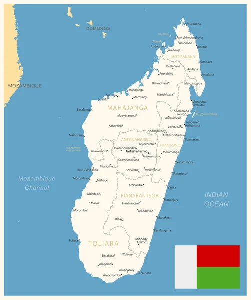
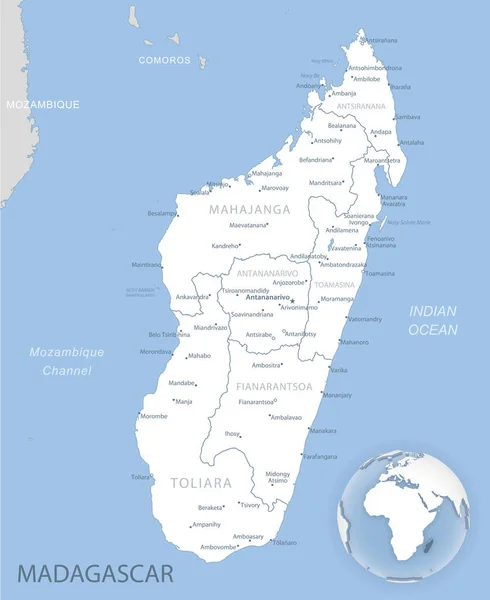
Stock vector Blue-gray detailed map of Madagascar administrative divisions and location on the globe.
Published:
Feb.05, 2021 15:30:59
Author:
gt29
Views:
4
Downloads:
0
File type:
vector
/
eps
File size:
9.69 MB
Orginal size:
5266
x
6441
px
Available sizes:
S
(409 x 500)
M
(818 x 1000)
L
(1635 x 2000)
XL
(5266 x 6441)
VECT
(5266 x 6441)
EL0
(5266 x 6441)
Level:
bronze
Download Vector
Vector topics:
White
Blue
Vector
Background
Set
Business
Travel
Abstract
Pattern
Border
Weather
3d
Gray
Icon
Shadow
Earth
Planet
World
Tourism
Globe
Collection
Sheet
Country
Map
Cartography
Geography
Africa
Continent
Separation
State
Political
Marker
Separated
Hemisphere
Madagascar
Provinces
Comoros
Mozambique
Territories
Antananarivo
Blue Gray
Municipalities
Administrative Divisions
Madagascar Island
Madagascar Map
Similar stock vectors
High Quality Map Of Madagascar . Vector Illustration
4000 × 4000
High Quality Map Of Madagascar
4167 × 4167
National Park Map Of The African Island Nation Of Madagascar
3100 × 3745
Vector Illustration Of Map Of Madagascar
2616 × 2738
Madagascar - Detailed Map With Administrative Divisions And Country Flag. Vector Illustration
6043 × 7213
Color Map Of Madagascar Country
4563 × 6181
Madagascar Highly Detailed Physical Map
6009 × 7500
Republic Of Madagascar - Vector Map
4440 × 3317