Home
Images
Vectors
Videos
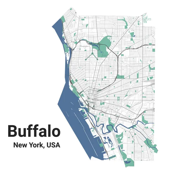
Stock vector Buffalo map, New York, American city. Municipal administrative area map with rivers and roads, parks and railways. Vector illustration.
Published:
Sep.29, 2023 13:32:37
Author:
Litteralis
Views:
4
Downloads:
1
File type:
vector
/
eps
File size:
14.81 MB
Orginal size:
4001
x
4001
px
Available sizes:
S
(500 x 500)
M
(1000 x 1000)
L
(2000 x 2000)
XL
(4001 x 4001)
VECT
(4001 x 4001)
EL0
(4001 x 4001)
Level:
bronze
Download Vector
Vector topics:
Color
Vector
Background
View
Graphic
Illustration
Travel
Border
Road
River
City
Urban
Way
Street
American
Usa
Tourism
Highway
Panorama
Cityscape
Skyline
Print
District
Map
Area
Tourist
State
Buffalo
Poster
America
Administrative
Parks
Roads
Municipal
Metropolitan
Borough
Municipality
Printable
Rivers
Railways
New York
City Map
Vector Map
Buffalo Map
Buffalo City
Map Of Buffalo
Similar stock vectors
Technical Drawing Printout City Poster With Panoramic Skyline And Streets Network On Blue Background Of The Downtown BUFFALO, NEW YORK
4080 × 6080
Dark Printout City Poster With Panoramic Skyline And Streets Network On Dark Gray Background Of The Downtown BUFFALO, NEW YORK
4080 × 6080
Buffalo New York City Skyline Silhouette White Background
5500 × 5499
Light Printout City Poster With Panoramic Skyline And Streets Network On Vintage Beige Background Of The Downtown BUFFALO, NEW YORK
4080 × 6080
Flat City Silhouette, Simple Vector Illustration
7000 × 2828
Buffalo, New York. Detailed City Silhouette
6000 × 3000
Yellow Printout City Poster With Panoramic Skyline And Streets Network On Dark Gray Background Of The Downtown BUFFALO, NEW YORK
4080 × 6080
New York State Detailed Editable Map
6500 × 4861