Home
Images
Vectors
Videos
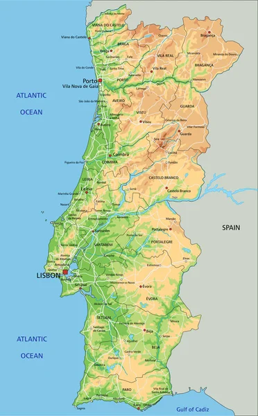
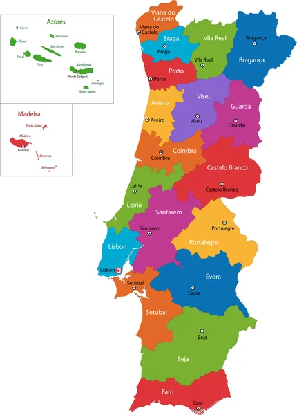
Stock vector Colorful Portugal political map with clearly labeled, separated layers. Vector illustration.
Published:
Feb.02, 2022 09:46:26
Author:
delpieroo
Views:
209
Downloads:
0
File type:
vector
/
eps
File size:
6.41 MB
Orginal size:
3517
x
5673
px
Available sizes:
S
(310 x 500)
M
(620 x 1000)
L
(1240 x 2000)
XL
(3517 x 5673)
VECT
(3517 x 5673)
EL0
(3517 x 5673)
Level:
bronze
Download Vector
Vector topics:
Green
Color
Yellow
Blue
Vector
Background
Colorful
Graphic
Colored
Illustration
Bright
Label
Travel
Orange
Vivid
European
Pastel
Purple
City
Capital
Europe
East
Country
Map
Cartography
Geography
Continent
Land
Mediterranean
Portugal
Topography
Political
Atlantic
Politics
Union
Geographic
Eu
Editable
Territory
Peninsula
Lisbon
Porto
Mapping
Portuguese
Rivers
Portugese
Iberian
Azores
Iberia
Similar stock vectors
Colorful Spain Political Map With Clearly Labeled, Separated Layers. Vector Illustration.
5671 × 3992
High Detailed Portugal Physical Map With Labeling.
3517 × 5673
Spain - Highly Detailed Editable Political Map With Separated Layers.
5671 × 3992
Spain Administrative Map
4468 × 3428
Map Of Spain With Regions And Their Capitals
6000 × 6000
Political Map Of Spain With National Borders, Cities And Rivers
4627 × 4000
Spain Administrative Map
4469 × 3428
Portugal Map
5378 × 7502