Home
Images
Vectors
Videos
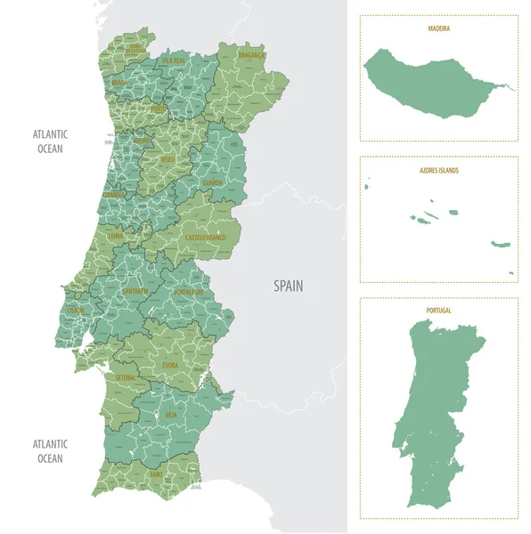
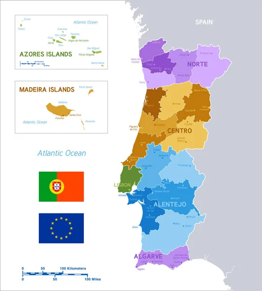
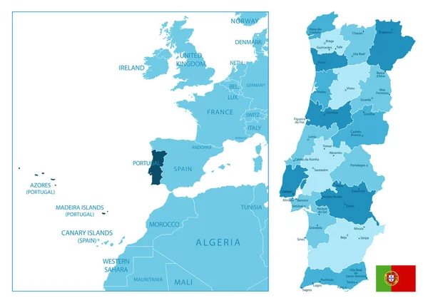
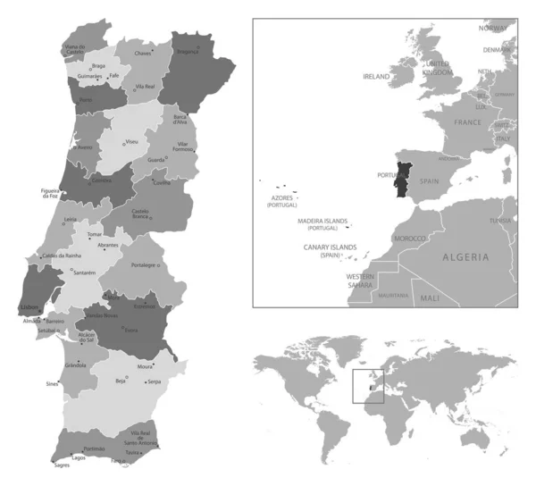
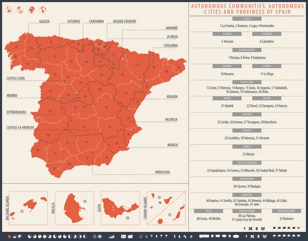
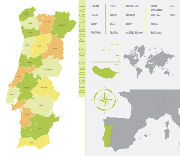
Stock vector Detailed administrative divisions map Portugal showing the location country on map of Europe, color vector illustration
Published:
Jan.27, 2021 09:47:24
Author:
martinova4
Views:
4
Downloads:
0
File type:
vector
/
eps
File size:
3.28 MB
Orginal size:
7677
x
6685
px
Available sizes:
S
(500 x 435)
M
(1000 x 871)
L
(2000 x 1742)
XL
(7677 x 6685)
VECT
(7677 x 6685)
EL0
(7677 x 6685)
Level:
beginner
Download Vector
Vector topics:
Blue
Vector
Background
Isolated
Travel
Sea
Border
Flag
Symbol
Icon
City
Contour
Education
World
Template
Ocean
Tourism
Europe
Globe
South
Country
Map
Cartography
Geography
Area
National
Continent
Land
Portugal
State
Political
Administrative
Atlantic
Braga
Geographic
Europa
Region
Atlas
Province
Nation
Porto
Portuguese
Lisboa
Madeira
Autonomous
Regions
Simplified
Coimbra
Infographic
Beja
Similar stock vectors
Detailed Map Of Portugal With Administrative Divisions Into Region And Municipalities, Major Cities Of Country, Vector Illustration Onwhite Background
7633 × 7677
Detailed Vector Map Of Portugal Regions With Flag
8268 × 5617
Colorful Political Vector Map Of Portugal And Main Islands With Flags Of Portugal And European Union
6000 × 6657
Portugal - Highly Detailed Blue Map. Vector Illustration
7402 × 5251
Portugal Country Map
5000 × 4286
Portugal - Highly Detailed Black And White Map. Vector Illustration
5779 × 5251
Infographics Map Of Spain With Administrative Division Into Autonomous Communities And Autonomous Cities And Provinces
7677 × 6012
Detailed Vector Map Of Spain, With Administrative Divisions Into Autonomous Communities And Islands
7677 × 3756