Home
Images
Vectors
Videos
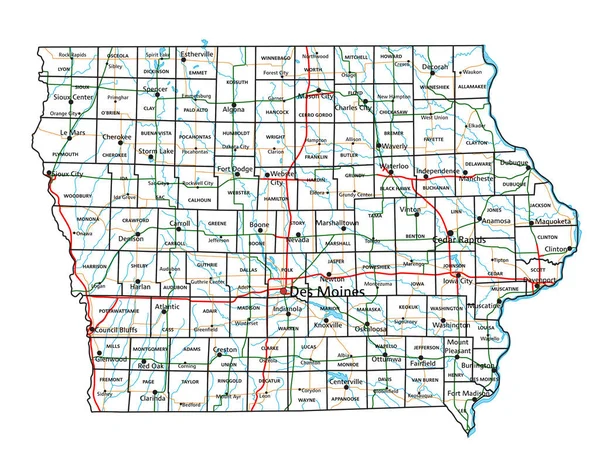
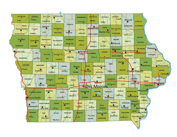
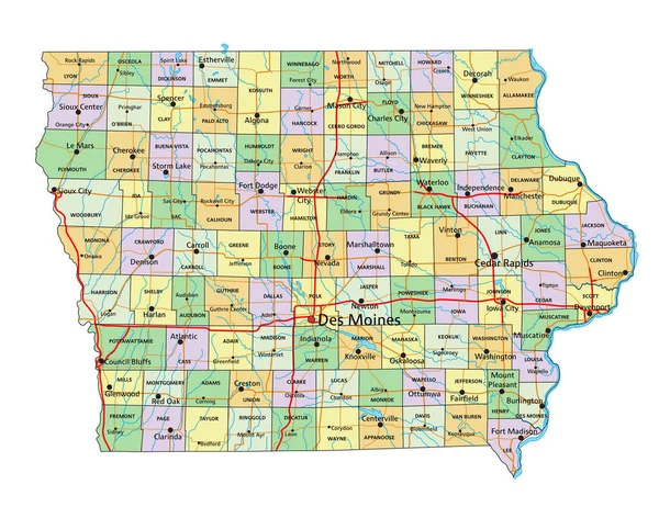
Stock vector Detailed map of Iowa state,in vector format,with county borders,roads and major cities
Published:
Jul.06, 2020 09:06:42
Author:
BogdanSerban
Views:
5
Downloads:
0
File type:
vector
/
eps
File size:
3.96 MB
Orginal size:
5000
x
3438
px
Available sizes:
S
(500 x 344)
M
(1000 x 688)
L
(2000 x 1375)
XL
(5000 x 3438)
VECT
(5000 x 3438)
EL0
(5000 x 3438)
Level:
beginner
Download Vector
Vector topics:
Vector
Background
Illustration
Travel
Silhouette
Border
Road
City
Outline
Country
Map
Cartography
Geography
State
Destination
Eps
Iowa
Waterloo
Davenport
Johnston
Des Moines
Cedar Rapids
Sioux City
Ames
Ankeny
Dubuque
Urbandale
Waukee
Similar stock vectors
Iowa Road And Highway Map. Vector Illustration.
4348 × 3351
Iowa Interstate Highway Map
8287 × 5868
Highly Detailed Editable Political Map With Separated Layers. Iowa.
4354 × 3357
Iowa - Highly Detailed Editable Political Map With Labeling.
4354 × 3357
Detailed Map Of Pennsylvania State,in Vector Format,with County Borders,roads And Major Cities
6000 × 3433
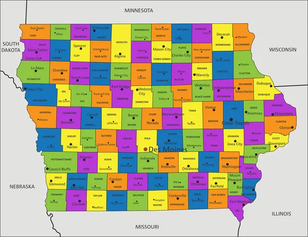
Colorful Iowa Political Map With Clearly Labeled, Separated Layers. Vector Illustration.
4352 × 3356
Detailed Map Of Missouri State,in Vector Format,with County Borders,roads And Major Cities
5000 × 4533
White Outline Counties Map Of US State Of Iowa
4800 × 3600