Home
Images
Vectors
Videos
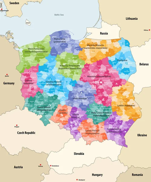
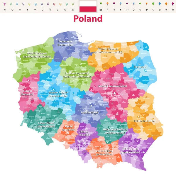
Stock vector Detailed map of Poland with flag, border of regions and country. Purple, yellow, green.
Published:
Apr.10, 2020 06:49:58
Author:
gt29
Views:
10
Downloads:
0
File type:
vector
/
eps
File size:
1.45 MB
Orginal size:
5241
x
6676
px
Available sizes:
S
(393 x 500)
M
(785 x 1000)
L
(1570 x 2000)
XL
(5241 x 6676)
VECT
(5241 x 6676)
EL0
(5241 x 6676)
Level:
bronze
Download Vector
Vector topics:
Green
Yellow
White
Vector
Background
Set
Business
Travel
Abstract
Pattern
European
Border
Weather
Flag
3d
Purple
Planet
Tourism
Europe
Globe
Collection
Polish
Layout
Sheet
Country
Map
Cartography
Icons
Geography
Continent
Separation
State
Political
Marker
Separated
Poland
Poznan
Warsaw
Wroclaw
Krakow
Gdansk
Provinces
Territories
Lodz
Municipalities
Infographics
Poland Flag
Poland Map
Administrative Divisions
Art World
Similar stock vectors
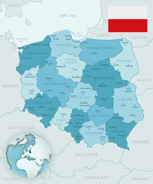
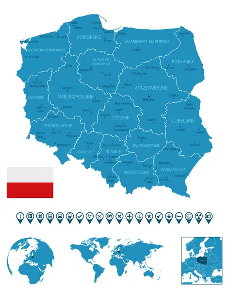
Blue-green Detailed Map Of Poland And Administrative Divisions With Country Flag And Location On The Globe.
5241 × 6293
Vector Map Of Poland Administrative Divisions Colored By Provinces(known As Voivodeships) With Neighbouring Countries An Territories
6947 × 8334
Poland - Detailed Blue Country Map With Cities, Regions, Location On World Map And Globe. Infographic Icons. Vector Illustration
5734 × 7275
Blue-green Detailed Map Of Latvia Administrative Divisions With Country Flag And Location On The Globe.
5594 × 5138
Central Europe
8946 × 7471
Hungary - Highly Detailed Blue Map. Vector Illustration
5149 × 6788
Vector Map Of Poland Provinces(known As Voivodeships) With Administrative Divisions. Polish Names Gives In Parentheses, Where They Differ From The English Ones.
7292 × 7292