Home
Images
Vectors
Videos
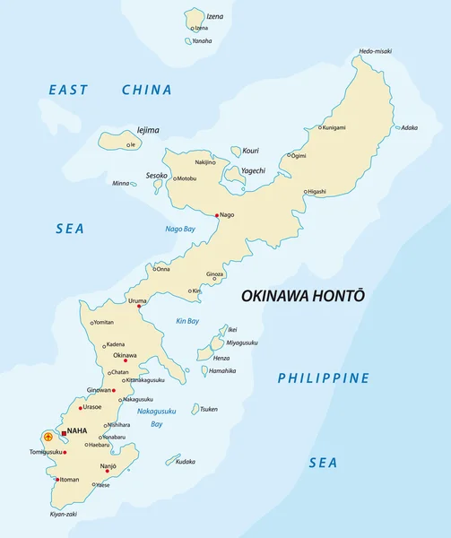
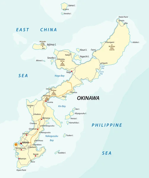
Stock vector Detailed vector road map of Japanese island Okinawa, Japan
Published:
Feb.28, 2018 13:14:57
Author:
Lesniewski
Views:
683
Downloads:
5
File type:
vector
/
eps
File size:
0.91 MB
Orginal size:
3100
x
3692
px
Available sizes:
S
(420 x 500)
M
(840 x 1000)
L
(1679 x 2000)
XL
(3100 x 3692)
VECT
(3100 x 3692)
EL0
(3100 x 3692)
Level:
bronze
Download Vector
Vector topics:
Vector
Background
Graphic
Illustration
Design
Travel
Sea
Border
Road
City
Ocean
Detailed
Town
East
Japanese
Outline
Country
Map
Cartography
Geography
Land
Asia
State
Japan
Island
Political
Administrative
Region
Philippine
Regions
Archipelago
Okinawa
Naha
Road Map
Similar stock vectors
Okinawa Map
1959 × 2334
Okinawa Map
4983 × 5820
Japan Map - Vector Illustration
5500 × 6771
A Map Of The North Japanese Island Hokkaido
3790 × 3100
Tohoku Map. Map Of Japan Prefecture. White Color. Vector Illustration.
5660 × 5384
Vector Map Of Japan With Regions And Administrative Divisions, And Neighbouring Countries. Editable And Clearly Labeled Layers.
4250 × 5000
Japan Political Map. Main Islands Honshu, Hokkaido, Kyushu, Shikoku And Okinawa. East Asian Island Country In The North Pacific Bordered By Sea Of Japan And Okhotsk, And East China And Philippine Sea.
6000 × 6000
Vector Road Map Of Japanese Island Hokkaido
3790 × 3100