Home
Images
Vectors
Videos
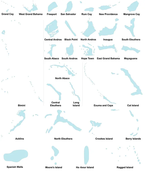
Stock vector District maps of the Bahamas
Published:
Dec.09, 2014 06:47:58
Author:
Malachy666
Views:
92
Downloads:
0
File type:
vector
/
ai
File size:
0.49 MB
Orginal size:
4270
x
5000
px
Available sizes:
S
(427 x 500)
M
(854 x 1000)
L
(1708 x 2000)
XL
(4270 x 5000)
VECT
(4270 x 5000)
EL0
(4270 x 5000)
Level:
bronze
Download Vector
Vector topics:
Vector
Illustration
Detail
Tropical
Country
District
Map
Paradise
Area
Land
State
America
Island
Politic
Political
Administrative
Tropic
Of
Islands
Region
Division
The
Administration
Province
Nation
County
Bahamas
Nassau
Freetown
Freeport
Counties
Coopers Town
Marsh Harbour
Rock Sound
Arthurs Town
Similar stock vectors
Vector Map Of The Ten Largest Lake In Germany In German
3984 × 5057
Shape Of Kepulauan Riau, Province Of Indonesia, With Its Capital Isolated On White Background. Colored Elevation Map. 3D Rendering
3836 × 3683
Polygonal Wire Frame Mesh High Detail Raster Map Of Cape Verde Islands Abstractions
4880 × 5123
Vector Map Of The Leeward Islands Belonging To The French Society Islands
5426 × 3100
Map Of Eleuthera Island, Bahamas, Contains Geography Outlines For Land Mass, Water, Major Roads And Minor Roads.
8000 × 8000
Colorful European Countries Political Map With Clearly Labeled, Separated Layers. Vector Illustration.
7197 × 5004
Scotland Administrative Divisions
5800 × 4800