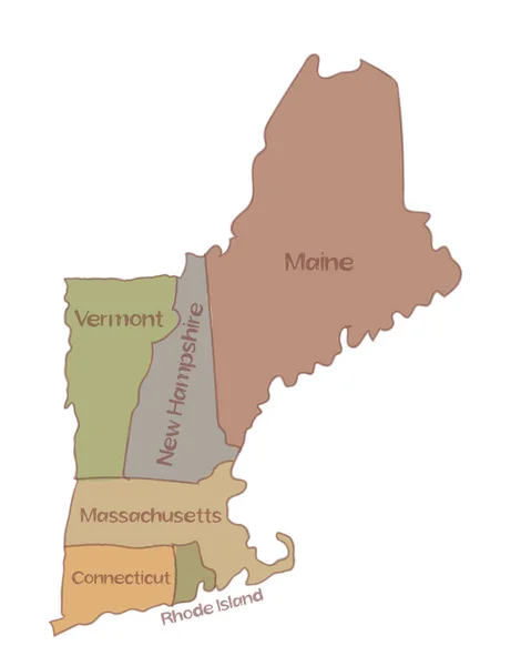
Stock vector Drawing of a map of New England states comprising six states in Northeastern United States, Connecticut, Maine, Massachusetts, New Hampshire, Rhode Island and Vermont on isolated background.
Published: Oct.18, 2021 09:22:01
Author: patrimonio
Views: 11
Downloads: 2
File type: vector / eps
File size: 4.63 MB
Orginal size: 5000 x 6250 px
Available sizes:
Level: silver