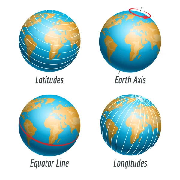
Stock vector Earth icons with latitudes longitudes lines
Published: Sep.20, 2016 12:20:22
Author: vectortatu
Views: 157
Downloads: 1
File type: vector / eps
File size: 14.18 MB
Orginal size: 4500 x 4500 px
Available sizes:
Level: silver