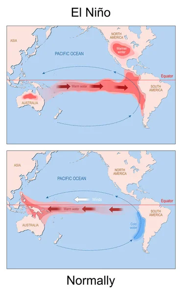
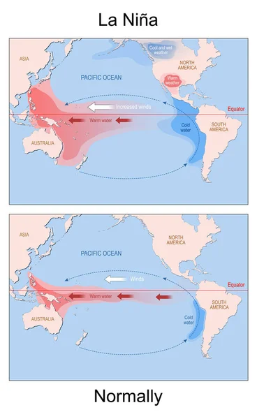
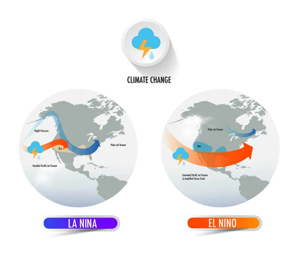
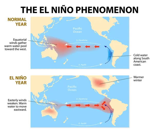
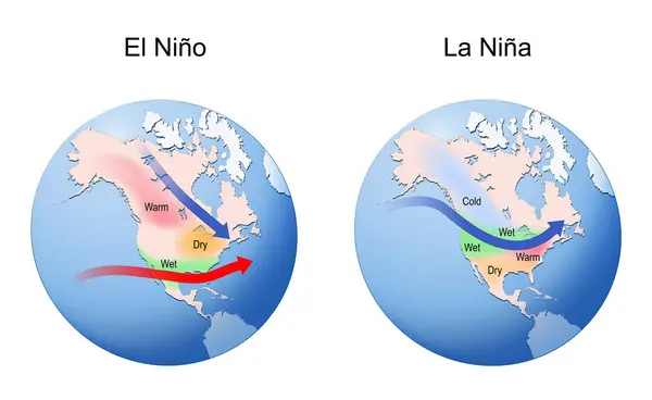
Stock vector El Nino and La Nina. Earth globe with continents and arrows that indicating the direction of warm and cold water and winds. Weather, Climate, oceanic and atmospheric phenomenon. vector illustration
Published: Aug.12, 2024 08:38:20
Author: edesignua
Views: 1
Downloads: 0
File type: vector / eps
File size: 5.92 MB
Orginal size: 5000 x 3075 px
Available sizes:
Level: silver