Home
Images
Vectors
Videos
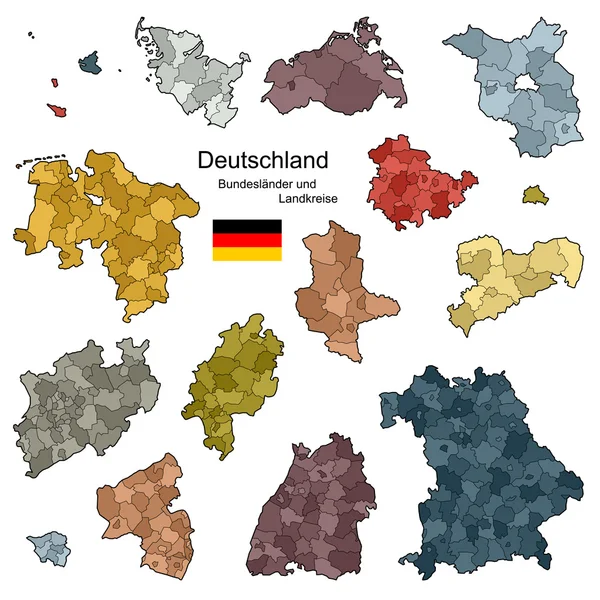
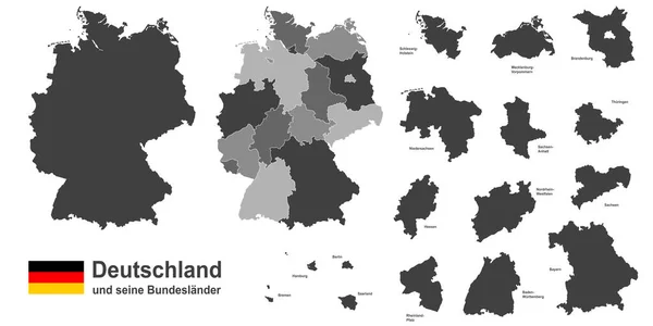
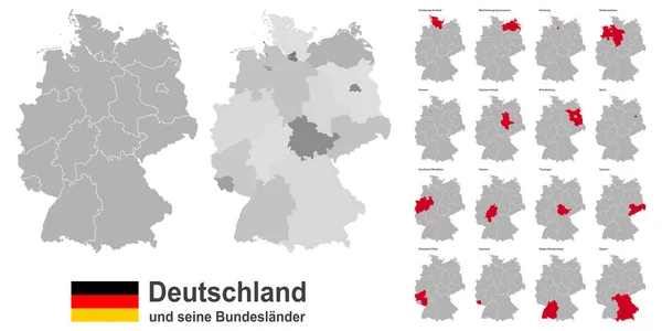
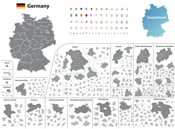
Stock vector federal states of Germany map with administrative districts and subdivisions
Published:
Sep.28, 2016 10:22:52
Author:
Jktu_21
Views:
427
Downloads:
42
File type:
vector
/
eps
File size:
14.45 MB
Orginal size:
7292
x
5394
px
Available sizes:
S
(500 x 370)
M
(1000 x 740)
L
(2000 x 1479)
XL
(7292 x 5394)
VECT
(7292 x 5394)
EL0
(7292 x 5394)
Level:
silver
Download Vector
Vector topics:
Set
Isolated
Travel
European
Flag
Symbol
Icon
Buttons
Navigation
Country
Map
Geography
National
Germany
Land
Location
Berlin
Deutschland
Region
Division
Bavaria
Subdivision
Bayern
Brandenburg
Bremen
Hamburg
Hesse
Saxony
Thuringia
Nordrhein Westfalen
Schleswig Holstein
Saxony Anhalt
Oberbayern
Rhineland Palatinate
Schwaben
Darmstadt
Oberpfalz
National Flag
Germany Flag
Lower Saxony
Location Icon
Navigation Buttons
Germany Map
Regional Map
North Rhine Westphalia
Baden Wuttenberg
Vorpommen
Similar stock vectors
Germany High Detailed Vector Map (colored By States And Administrative Districts) With Subdivisions. All Layers Detachable And Labeled.
7292 × 8512
Vector High Detailed Map Of Germany Metropolitan Regions (areas)
6456 × 8334
High Detailed Germany Map Collection, Red Marked Federal States In Separated Maps Illustratiions
5000 × 5000
Germany And Federal States
5079 × 5079
Provinces And Districts Of Germany
5079 × 5079
Map Of Germany - Federal States And Counties
4471 × 5906
West European Country Germany And The Federal States
11811 × 5906
West European Country Germany And The Federal States
11811 × 5906