Home
Images
Vectors
Videos
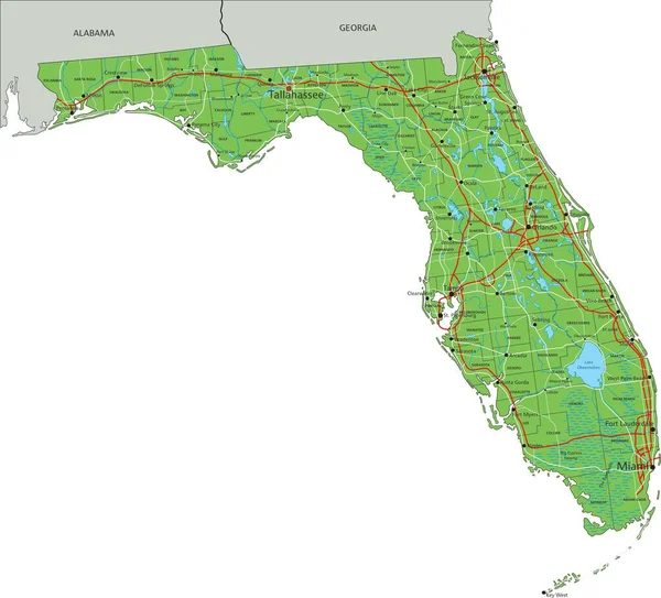
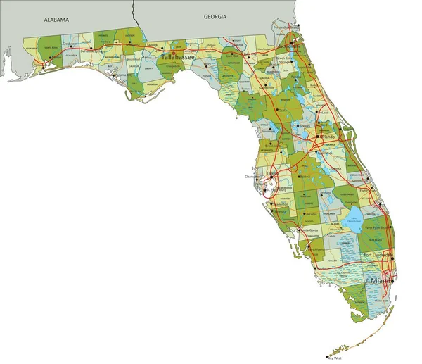
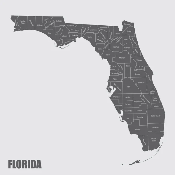
Stock vector Florida highly detailed vector map with county names,main cities and roads.
Published:
Jun.30, 2020 08:35:47
Author:
BogdanSerban
Views:
7
Downloads:
0
File type:
vector
/
eps
File size:
1.88 MB
Orginal size:
5000
x
4805
px
Available sizes:
S
(500 x 481)
M
(1000 x 961)
L
(2000 x 1922)
XL
(5000 x 4805)
VECT
(5000 x 4805)
EL0
(5000 x 4805)
Level:
beginner
Download Vector
Vector topics:
Vector
Illustration
Silhouette
Border
Road
City
Bay
Ocean
Tourism
Highway
Panama
Florida
County
Charlotte
Miami
Orlando
Pensacola
Tallahassee
Sarasota
Jacksonville
Tampa
Dade
Gainesville
Deltona
Similar stock vectors
Road Map Of The US American State Of Florida
4396 × 4053
Florida Road Map With National Parks
4562 × 4254
Florida And Its Counties
5000 × 5000
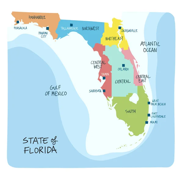
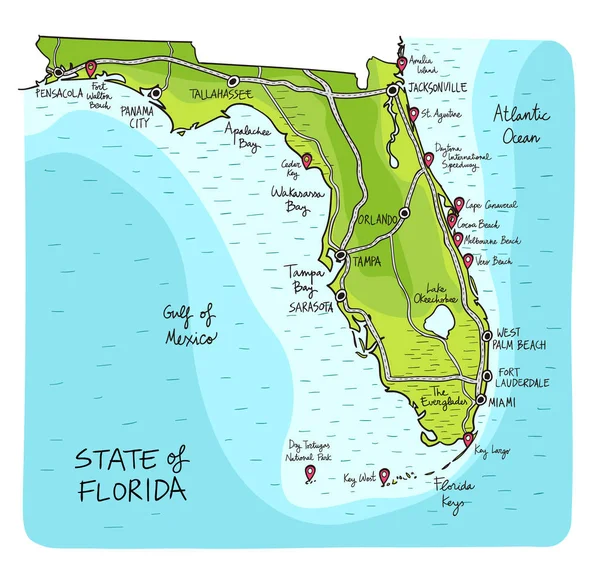
Hand Drawn Map Of The State Of Florida With Regions Counties And Main Cities. Colorful Sketch Style
6001 × 5758
Hand Drawn Map Of The State Of Florida With Main Cities And Points Of Interest. Colorful Sketch Style
6001 × 5757
High Detailed Florida Physical Map With Labeling.
7372 × 6675
BLUE CMYK Color Detailed Flat Map Of The Federal State Of FLORIDA, UNITED STATES OF AMERICA On Transparent Background
5100 × 4880
Highly Detailed Editable Political Map With Separated Layers. Florida
7828 × 6749