Home
Images
Vectors
Videos
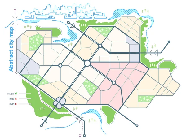
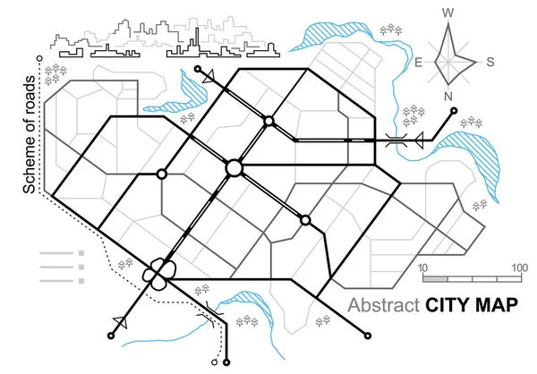
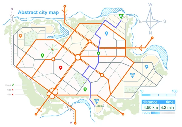
Stock vector Generic map of an imaginary city, with the specified road route. Scheme of town streets on the plan. Navigation icons and GPS dashboard. Stock vector
Published:
Mar.02, 2018 09:57:52
Author:
Parmenow
Views:
333
Downloads:
4
File type:
vector
/
eps
File size:
1.97 MB
Orginal size:
5473
x
3819
px
Available sizes:
S
(500 x 349)
M
(1000 x 698)
L
(2000 x 1396)
XL
(5473 x 3819)
VECT
(5473 x 3819)
EL0
(5473 x 3819)
Level:
bronze
Download Vector
Vector topics:
Color
Vector
Background
Environment
Transport
Transportation
Road
Icon
City
Downtown
Urban
Mark
Global
Street
Project
Route
Highway
Track
Town
Navigation
District
Direction
Map
Cartography
Geography
Plan
Architectural
Dashboard
Distance
Navigator
Guide
Location
Place
Scheme
Imaginary
Destination
Interface
Crossroad
Avenue
Tracking
Generic
Gps
Positioning
Roadmap
Gen
Top View
Wind Rose
Urban Planning
Master Plan
General Plan
Similar stock vectors
Generic Map Of An Imaginary City, With The Specified Road Route. Scheme Of Town Streets On The Plan. Navigation Icons And GPS Dashboard. Stock Vector
5473 × 3819
Generic Map Of Abstract City. Urban Environment With Scheme Of Town Streets On The Plan. Architectural Sketch Of The General Plan In Top View. Stock Vector
5473 × 3819
Generic Map Of Abstract City. Urban Environment With Scheme Of Town Streets On The Plan. Architectural Sketch Of The General Plan In Top View. Stock Vector
5069 × 3819
City Map. Line Scheme Of Roads. Town Streets On The Plan. Urban Environment, Architectural Background. Linear Architectural Sketch General Plan. Vector
5473 × 3819
Pastel Flat Blank Vector Administrative Map Of BREDA, NETHERLANDS With Black Border Lines Of Its Neighborhoods
4378 × 5509
Citymap With Marker Icons
5100 × 5742
Digital Art Map City
16000 × 9000
Metro Map Of San Francisco And The California Bay Area
3100 × 3368