Home
Images
Vectors
Videos
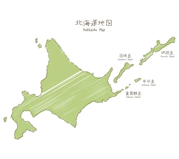
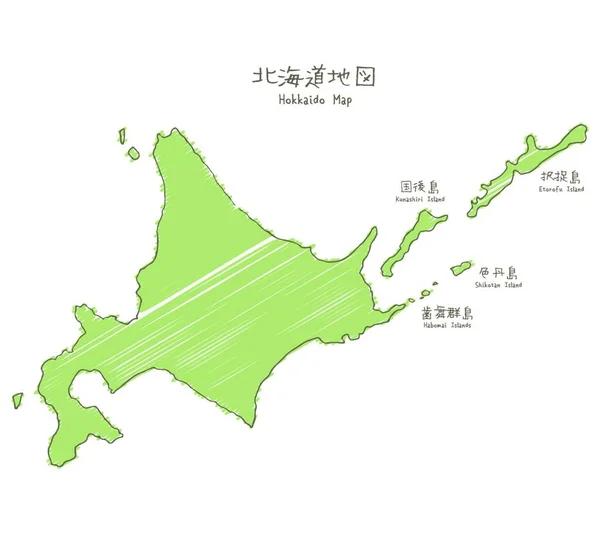
Stock vector Hand-drawn Hokkaido sketch map, the northernmost of the four main islands of Japan
Published:
Apr.15, 2020 14:03:03
Author:
PantherMediaSeller
Views:
6
Downloads:
0
File type:
vector
/
zip
File size:
0 MB
Orginal size:
4000
x
3943
px
Available sizes:
S
(500 x 493)
M
(1000 x 986)
L
(2000 x 1972)
XL
(4000 x 3943)
VECT
(4000 x 3943)
EL0
(4000 x 3943)
Level:
platinum
Download Vector
Vector topics:
Green
White
Vector
Illustration
Travel
Brown
Line
Hand
Simple
Japanese
Sketch
Map
Geography
Four
Japan
Chart
Drawn
Handdrawn
Island
Islands
English
Main
Prefecture
Freehand
Hokkaido
White Background
Design Elements
Line Drawing
Northernmost
Graphic Elements
Travel Map
Hokkaido Prefecture
Hokkaido Map
Northern Island
Map Of Hokkaido
Kunashiri Island
Island Of Japan
Hokkaido Sland
Habomai Islands
Shikotan Island
Etorofu Island
Similar stock vectors
Hand-drawn Hokkaido Sketch Map, The Northernmost Of The Four Main Islands Of Japan
4500 × 4000
Hand-drawn Hokkaido Sketch Map, The Northernmost Of The Four Main Islands Of Japan
4500 × 4000
North Korea / South Korea And Japan / Far East Asia Map / Japanese
4713 × 5510
North Korea / South Korea And Far East Asia Map / Japanese
4896 × 6650
Map Of Japan
4520 × 4520
"Map Of Japan, Watercolor Texture / Translation Of Japanese ""Watercolor"" ""Map Of Japan"""
4000 × 4000
Map Of Japan, Regional Division With Colors / Translation Of Japanese "Map Of Japan"
4000 × 4000