Home
Images
Vectors
Videos
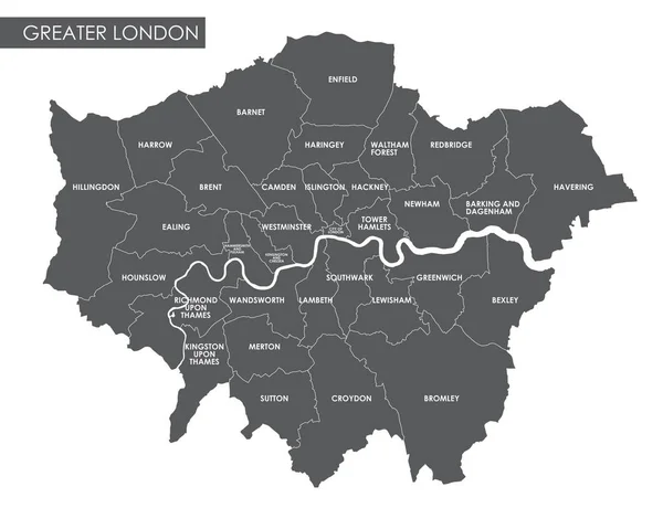
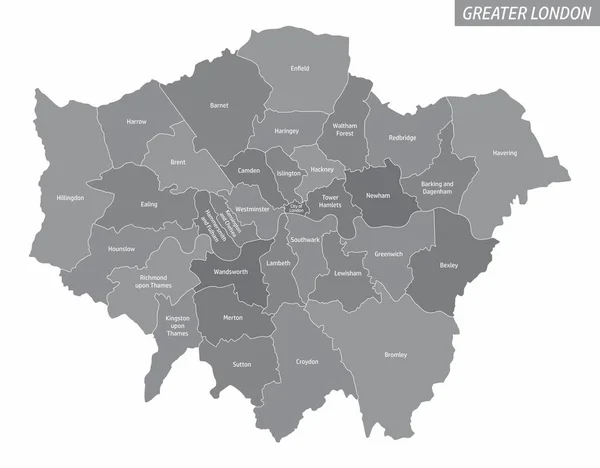
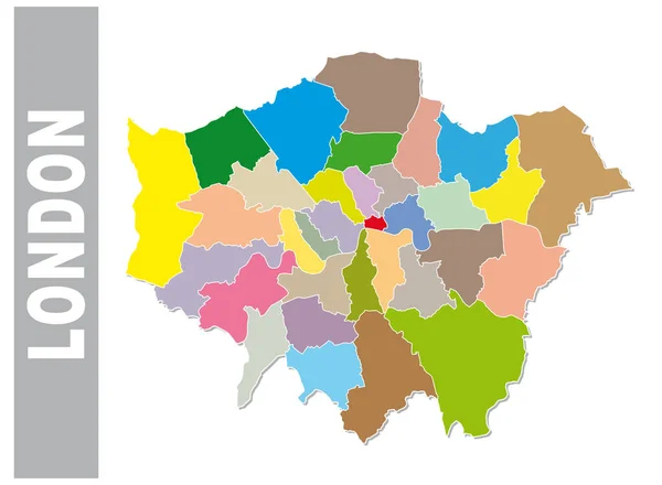
Stock vector High Quality map of London is a city in United Kingdom, with borders of districts
Published:
Oct.23, 2018 14:34:45
Author:
grebeshkovmaxim@gmail.com
Views:
8
Downloads:
0
File type:
vector
/
eps
File size:
2.71 MB
Orginal size:
4000
x
4000
px
Available sizes:
S
(500 x 500)
M
(1000 x 1000)
L
(2000 x 2000)
XL
(4000 x 4000)
VECT
(4000 x 4000)
EL0
(4000 x 4000)
Level:
silver
Download Vector
Vector topics:
Image
White
Vector
Background
Graphic
Illustration
Art
Travel
Abstract
Silhouette
Border
Card
Retro
Vintage
City
Downtown
Stylized
Simple
Drawing
Town
Capital
Vacation
Outline
Map
Cartography
Geography
Area
Land
Accurate
Administrative
Interstate
States
London
Region
British
Boundaries
England
Atlas
Borderline
Borough
Typographical
United Kingdom
Communes
Similar stock vectors
London Regions Map
5000 × 4500
Vector Greater London Administrative Map
6995 × 5596
Grey County Map Of England, London
6180 × 5000
Vector Map Of Greater London With Main Roads, Uk
3897 × 3100
Greater London Map Showing Southwark Borough In Blue. 3D Rendering
5000 × 3356
The Greater London Administrative Map With Labels Isolated On White Background
5000 × 3900
Colorful London Administrative And Political Map
4226 × 3100
Greater London Map Showing City Of London In Blue. 3D Rendering
5000 × 3356