Home
Images
Vectors
Videos
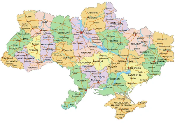
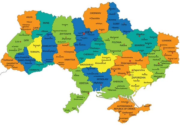
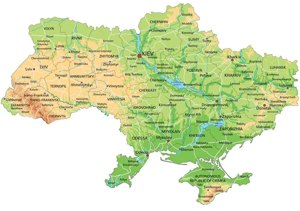
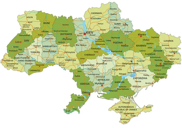
Stock vector Highly detailed editable political map with separated layers. Ukraine.
Published:
Feb.02, 2022 09:46:17
Author:
delpieroo
Views:
210
Downloads:
16
File type:
vector
/
eps
File size:
6.72 MB
Orginal size:
5671
x
4005
px
Available sizes:
S
(500 x 353)
M
(1000 x 706)
L
(2000 x 1412)
XL
(5671 x 4005)
VECT
(5671 x 4005)
EL0
(5671 x 4005)
Level:
bronze
Download Vector
Vector topics:
Green
Vector
Background
Colored
Illustration
Shape
Label
Travel
European
Road
Pastel
City
Contour
Crimea
Ocean
Ukraine
Capital
North
Olive
Shade
East
Outline
Country
Map
Cartography
Geography
Continent
Land
War
Topography
Political
Administrative
Atlantic
Politics
Geographic
Kiev
Eu
Region
Lime
Editable
Territory
Atlas
Ukrainian
Azov
Chernobyl
Mapping
Sevastopol
Rivers
Black Sea
Similar stock vectors
Ukraine - Highly Detailed Editable Political Map With Labeling.
5671 × 4005
Highly Detailed Editable Political Map With Separated Layers. Belgium.
5404 × 4252
Highly Detailed Editable Political Map With Separated Layers. Lithuania.
3000 × 2267
Colorful Ukraine Political Map With Clearly Labeled, Separated Layers. Vector Illustration.
5672 × 4005
Belgium - Highly Detailed Editable Political Map With Labeling.
5404 × 4252
High Detailed Ukraine Physical Map With Labeling.
5671 × 4005
High Detailed Belgium Physical Map With Labeling.
5404 × 4252
Map Of Brandenburg
4045 × 4002