Home
Images
Vectors
Videos
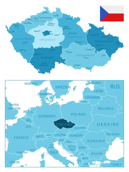
Stock vector Highly detailed vector map of Czech and Slovak Republics with administrative regions, main cities and roads.
Published:
Jun.30, 2020 08:37:51
Author:
BogdanSerban
Views:
8
Downloads:
0
File type:
vector
/
eps
File size:
2.56 MB
Orginal size:
5000
x
3087
px
Available sizes:
S
(500 x 309)
M
(1000 x 617)
L
(2000 x 1235)
XL
(5000 x 3087)
VECT
(5000 x 3087)
EL0
(5000 x 3087)
Level:
beginner
Download Vector
Vector topics:
Vector
Illustration
Shape
Border
City
Artistic
Ukraine
Capital
Europe
Czech
Outline
Map
Cartography
Geography
Germany
Republic
Vienna
Division
Poland
Prague
Austria
Budapest
Hungary
Slovakia
Romania
Brno
Czechoslovakia
Bratislava
Salzburg
Plzen
Liberec
Kitzbuhel
Ostrava
Zilina
Teplice
Kosice
Trnava
Gyor
Mlada
Boleslav
Olomuc
Similar stock vectors
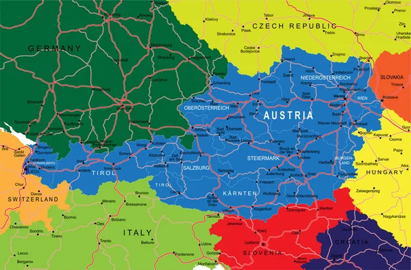
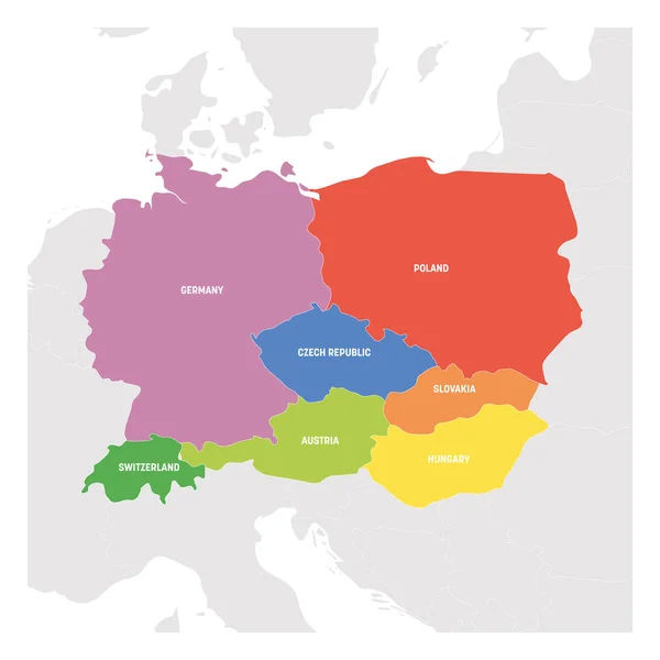
Highly Detailed Vector Map Of Austria With Administrative Regions, Main Cities And Roads.
5000 × 3298
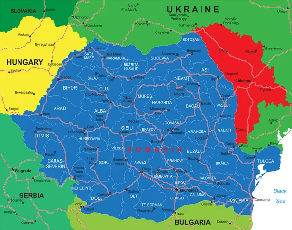
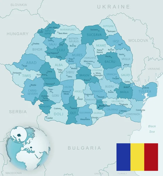
Highly Detailed Vector Map Of Romania With Administrative Regions, Main Cities And Roads.
5000 × 3949
Czech Republic - Highly Detailed Blue Map. Vector Illustration
5251 × 6968
Blue-green Detailed Map Of Romania Administrative Divisions With Country Flag And Location On The Globe. Vector Illustration
5332 × 5754
Central Europe Region. Map Of Countries In Central Part Of Europe. Vector Illustration
6000 × 6000
Map Of Austria On Earth
5000 × 3750
Central Europe Region. Colorful Map Of Countries In Central Part Of Europe. Vector Illustration
6000 × 6000
Blue-green Detailed Map Of Poland And Administrative Divisions With Country Flag And Location On The Globe.
5241 × 6293