Home
Images
Vectors
Videos
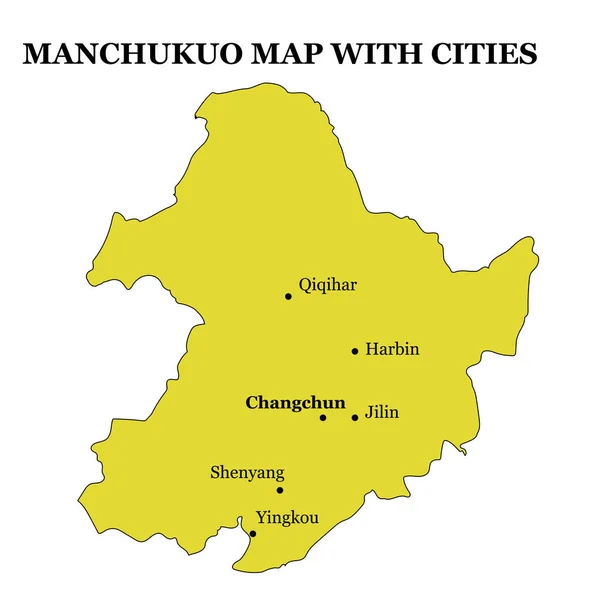
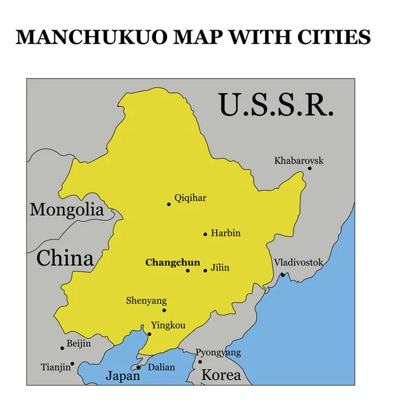
Stock vector historical map of Manchukuo on the territory of modern China State of Manchuria during world war II with neighbouring countries and major cities vector illustration
Published:
Mar.04, 2019 07:53:32
Author:
igormpgu2002
Views:
380
Downloads:
1
File type:
vector
/
eps
File size:
5.25 MB
Orginal size:
4000
x
4000
px
Available sizes:
S
(500 x 500)
M
(1000 x 1000)
L
(2000 x 2000)
XL
(4000 x 4000)
VECT
(4000 x 4000)
EL0
(4000 x 4000)
Level:
beginner
Download Vector
Vector topics:
Vector
Illustration
Isolated
Border
Contour
China
Outline
Country
Map
Cartography
Geography
History
Land
State
Historical
Japan
Empire
Region
Cities
Territory
Major
World War II
Manchuria
Manchukuo
Graphical Material
Similar stock vectors
Historical Map Of Manchukuo On The Territory Of Modern China State Of Manchuria During World War II With Major Cities Illustration
4000 × 4000
Shandong Map With Major Cities Region Of China Vector Illustration
4000 × 4000
Chungcheongbuk South Korea Map In Grey
5000 × 5470
The Detailed Map Of The China With Regions
7500 × 7500
District Map Of Guangzhou In Southern China
3100 × 3931
Hainan, The Smallest And Southernmost Province Of China, PRC, Gray Political Map. Hainan Island With Capital Haikou, And Various Smaller Islands In The South China Sea, South Of The Leizhou Peninsula.
6000 × 6000
China Country Vector Illustration
5000 × 4747
Loupe Finds Nanchang City On The Map, 3d Rendering
4000 × 2250