Home
Images
Vectors
Videos
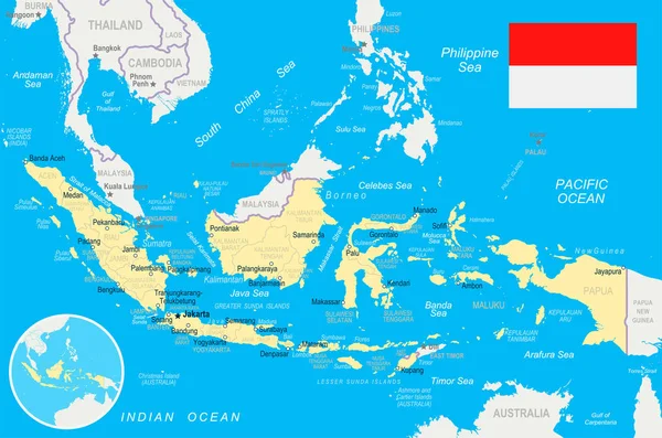
Stock vector indonesia administrative vector map with flag
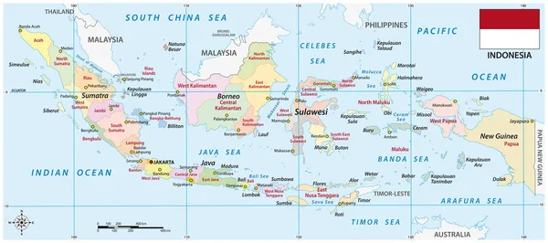
Published:
Oct.19, 2021 09:04:27
Author:
Lesniewski
Views:
145
Downloads:
5
File type:
vector
/
eps
File size:
2.42 MB
Orginal size:
6972
x
3100
px
Available sizes:
S
(500 x 222)
M
(1000 x 445)
L
(2000 x 889)
XL
(6972 x 3100)
VECT
(6972 x 3100)
EL0
(6972 x 3100)
Level:
bronze
Download Vector
Vector topics:
Color
Vector
Background
Colorful
Graphic
Illustration
Design
Detail
Cut
Flag
City
Scale
Outline
Country
District
Map
Cartography
Geography
Area
Asia
State
Boundary
Island
Political
Administrative
Java
Republic
Region
Division
Atlas
Southeast
Province
Nation
Subdivision
Indonesia
Geographical
Borneo
Sumatra
Archipelago
Jakarta
Sulawesi
Kalimantan
Maluku
South China Sea
Pacific Ocean
Indian Ocean
New Guinea
Timor Sea
Celebes Sea
Similar stock vectors
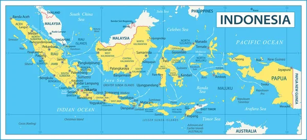
Detailed Indonesia Administrative Map With Country Flag And Location On A Blue Globe. Vector Illustration
8950 × 5322
Map Of Indonesia - Highly Detailed Vector Illustration
6882 × 3144
Southeast Asia Vector Map With Coordinates And Scale.
3666 × 3100
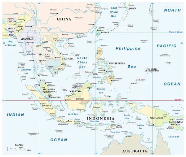
Blue-gray Detailed Map Of Indonesia Administrative Divisions And Location On The Globe. Vector Illustration
7844 × 5222
Map Of Indonesia
5562 × 2877
Indonesia Map, Administrative Division With Names Regions, Colors Map Isolated On White Background Vector
5828 × 3300
Map Of Indonesia
5562 × 2877
Indonesia - Map And Flag Illustration
8700 × 5760