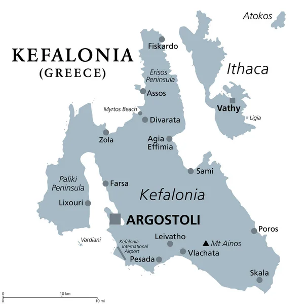
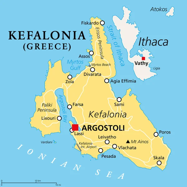
Stock vector Kefalonia, Greek island, political map. Also known as Cephalonia, Kefallinia or Kephallenia, the largest Ionian Island, located in western Greece and in the Ionian Sea, with capital Argostoli. Vector.
Published: Apr.21, 2023 18:31:56
Author: Furian
Views: 458
Downloads: 1
File type: vector / eps
File size: 1.61 MB
Orginal size: 6000 x 6000 px
Available sizes:
Level: silver