Home
Images
Vectors
Videos
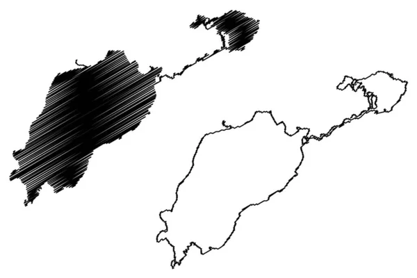
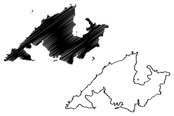
Stock vector King George island (South Shetland Islands Archipelago, Antarctica) map vector illustration, scribble sketch Isla 25 de Mayo, Isla Rey Jorge or Vaterloo map
Published:
Mar.23, 2022 07:11:42
Author:
Danler
Views:
2
Downloads:
0
File type:
vector
/
eps
File size:
0.95 MB
Orginal size:
7087
x
4726
px
Available sizes:
S
(500 x 333)
M
(1000 x 667)
L
(2000 x 1334)
XL
(7087 x 4726)
VECT
(7087 x 4726)
EL0
(7087 x 4726)
Level:
bronze
Download Vector
Vector topics:
Vector
Illustration
Design
Isolated
Sign
Travel
Abstract
Texture
Black
Line
Silhouette
Border
Symbol
Icon
Flat
Contour
Simple
Drawing
Scratch
Ocean
Tourism
Sketch
Outline
Country
Map
Cartography
Geography
Area
Continent
State
Topography
Island
Administrative
Delineation
Region
Scribble
Division
Territory
Borderline
Antarctica
Patriotic
Province
Nation
Autonomy
Oblast
Archipelago
King George
Similar stock vectors
Azuchi-Oshima Island (Japan, East Asia, Japanese Archipelago) Map Vector Illustration, Scribble Sketch Azuchi Oshima Map
7087 × 4726
Uto Island (Kingdom Of Sweden, Stockholm Archipelago) Map Vector Illustration, Scribble Sketch Map
7087 × 4726
Usti Nad Labem Region (Bohemian Lands, Czechia, Regions Of The Czech Republic) Map Vector Illustration, Scribble Sketch Usti Nad Labem (Ustecky Region) Map
7087 × 4726
Newcastle Under Lyme Non-metropolitan District, Borough (United Kingdom Of Great Britain And Northern Ireland, Ceremonial County Staffordshire Or Staffs, England) Map Vector, Scribble Sketch Map
7087 × 4726
Lake Edward And George (Africa, Republic Of Uganda, Democratic Republic Of The Congo, Congo-Kinshasa, DR Congo) Map Vector Illustration, Scribble Sketch Rwitanzigye Or Rweru And Katunguru Map
7087 × 4726
Rajkot District (Gujarat State, Republic Of India) Map Vector Illustration, Scribble Sketch Rajkot Map
7087 × 4726
Washim District (Maharashtra State, Amravati Division, Republic Of India) Map Vector Illustration, Scribble Sketch Washim Map
7087 × 4726
Borough And Unitary Authority Of Cheshire East (United Kingdom Of Great Britain And Northern Ireland, Ceremonial County Cheshire, England) Map Vector Illustration, Scribble Sketch Map
7087 × 4726